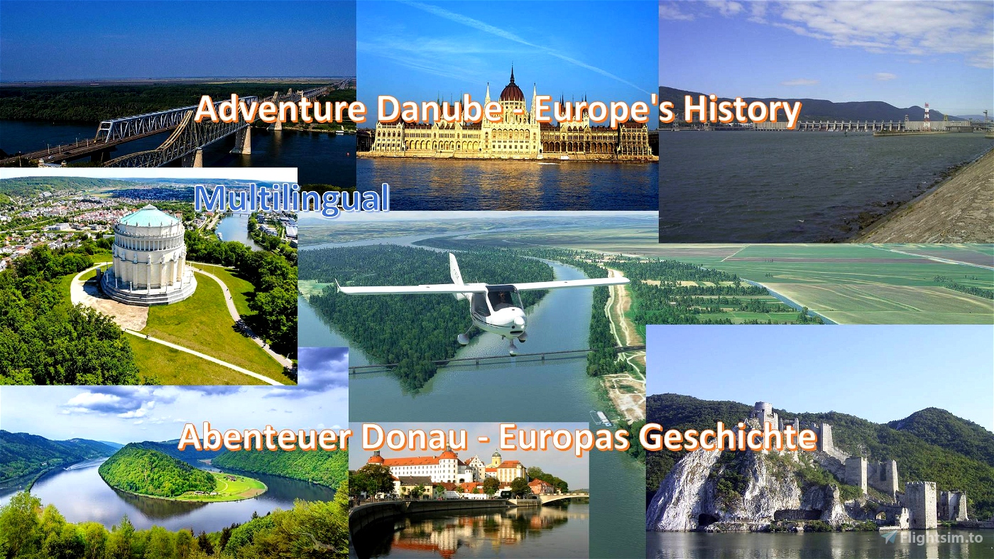
Adventure Danube - Europe's history
From the Danube source to the black sea
Along the Danube is certainly no world trip but a world trip through the worlds of history, culture and developments of the European community. When I started planning this virtual journey in the simulator, I could not suspect how captivating it is to get insights into the various epochs of war and peace, destruction and development or past and presence in places I to Part has never been.
From the beginning of the Roman Empire, along the Danube, to the end of World War II, there was hardly a decade of peace in Europe. Even in the years 1991-1995 there was a terrible war in the Balkans, the tens of thousands of people have fallen victim. How much blood this river has seen and mostly he separated people from each other. In the Roman Empire as Limes Via Istrum, which should protect the Western culture from the barbarians (as if they had no culture), and today the Danube is predominantly border flow between different states and nations. But there are now many connecting bridges over the Danube, which people can communicate. If we could build these bridges in our heads, it would go as well to people in Europe as never before.
Installation:
Unpack the contained folder from the package into the community folder. Start the simulator new.
Specification:
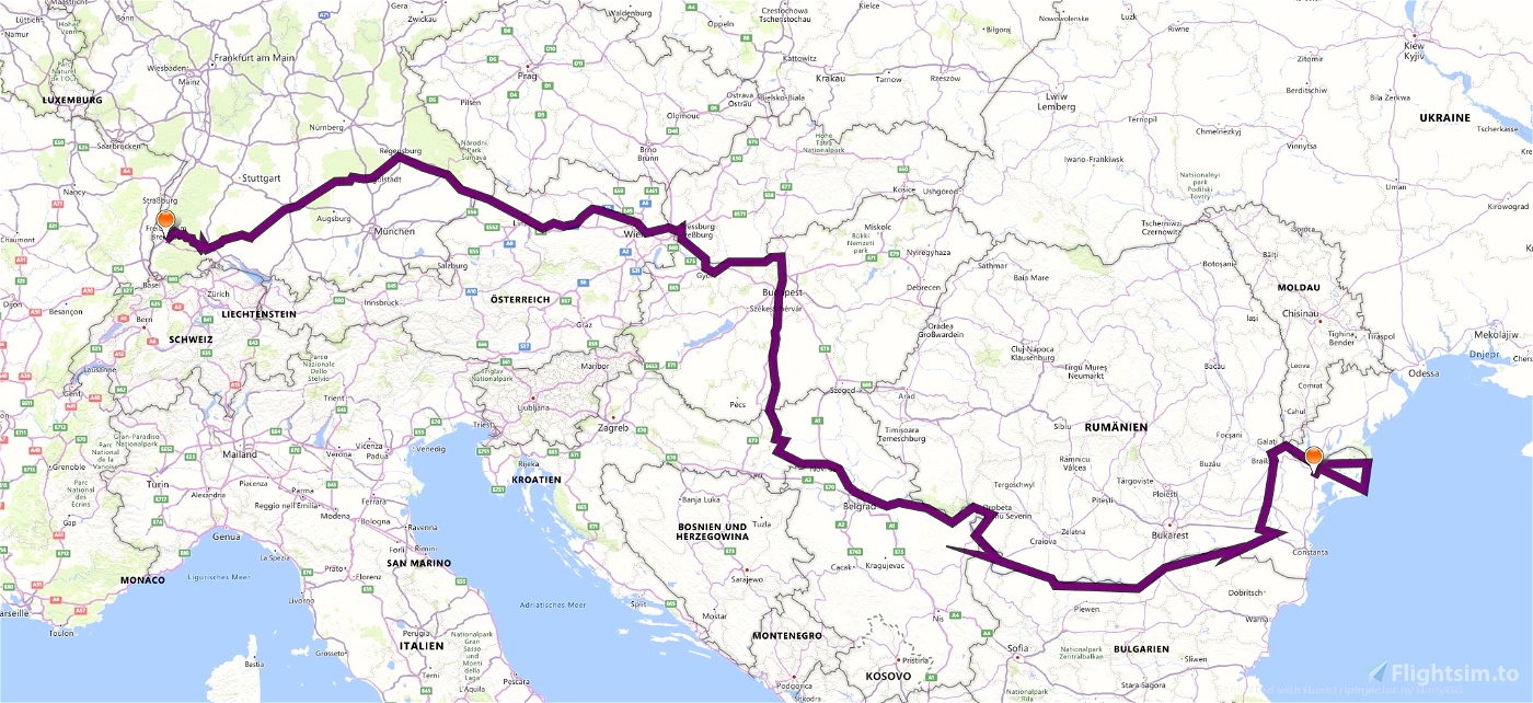
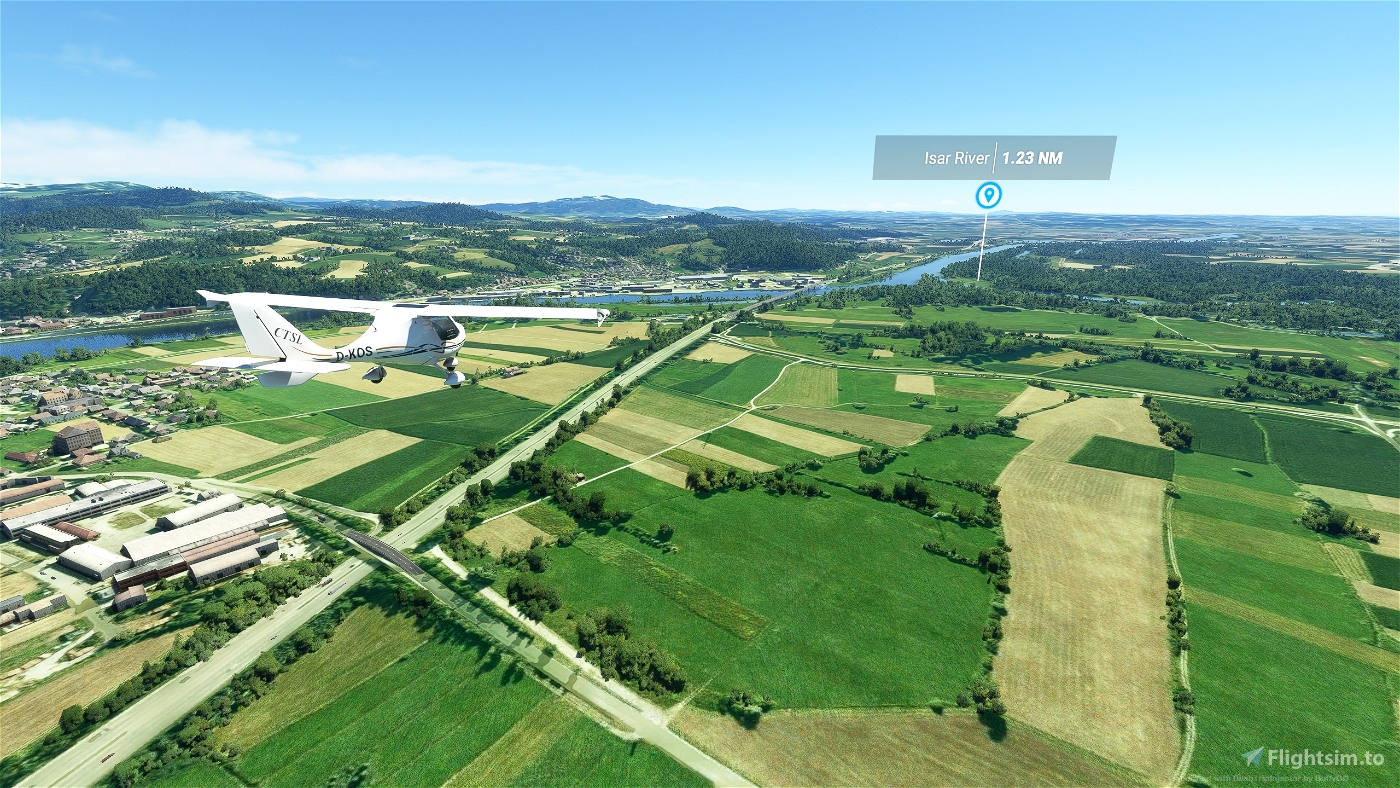
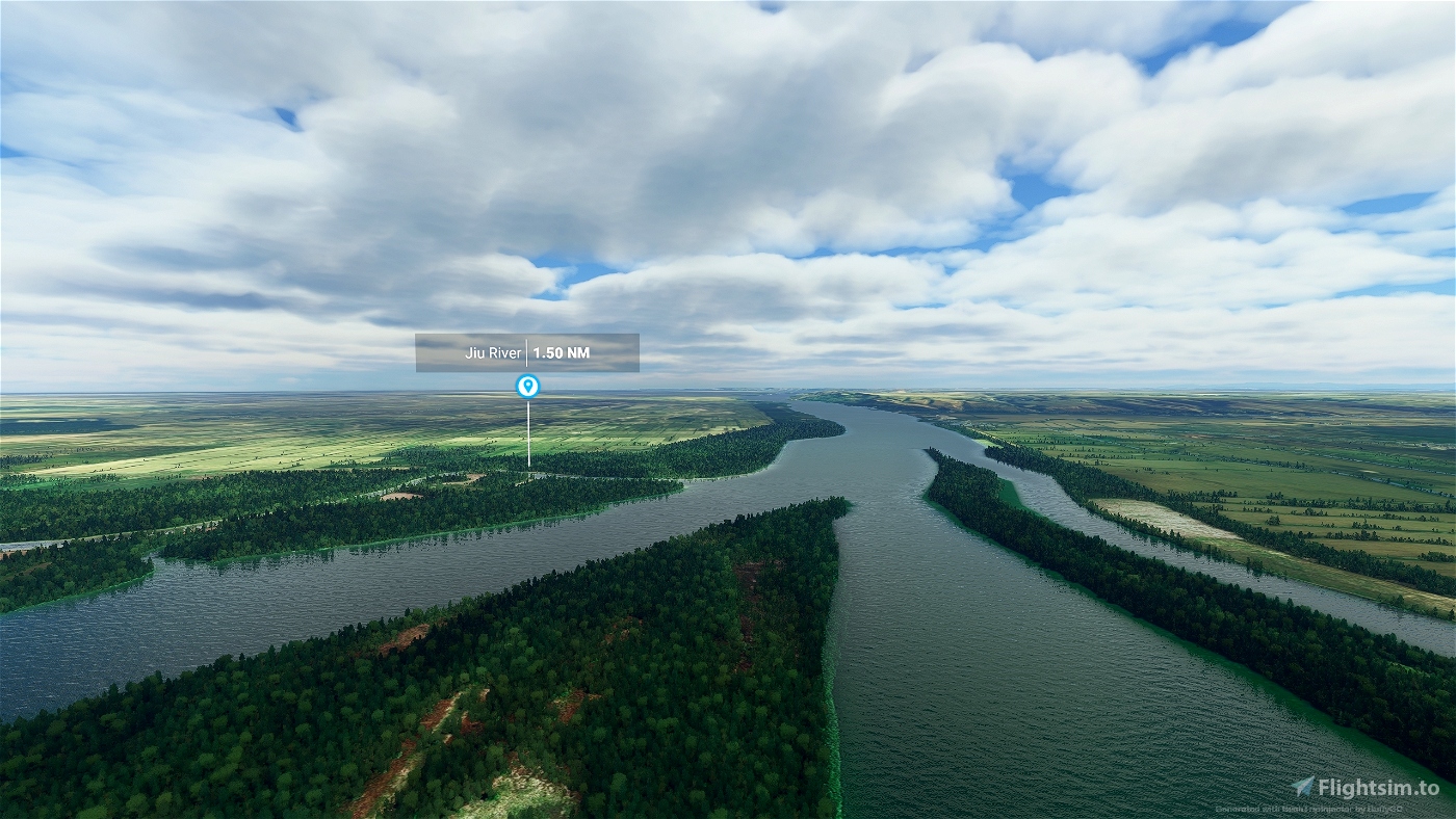
- Over 27 legs, the Danube walks along the source to her delta to the black sea. The mission has a total length of 1,400 nm, with an average length of the legs of about 60 nm.
- The small FlightDesignCT is the optimal airplane, especially because some very short slopes are to be overcome. The plane is interchangeable with some handmade, see exchange file. Alternatively, there is also the MissionChanger from BuffyGC.
- The package is multilingual in the languages: English US, Spanish, French, Italian, Polish, Portuguese BR, Portuguese, Russian, Dutch, Finnish, Norwegian and Swedish. The basic language is German. The other languages are mechanically translated, so there may be errors in the translation. If you have a better translation, please send me.
- At each waypoint, there are instructions in English from the artificial voice output when you skim the corresponding waypoint. However, all instructions can be read in the NavLog. If you don't hit the waypoint, this has no further effect. The only important thing is that you land at the right airport.
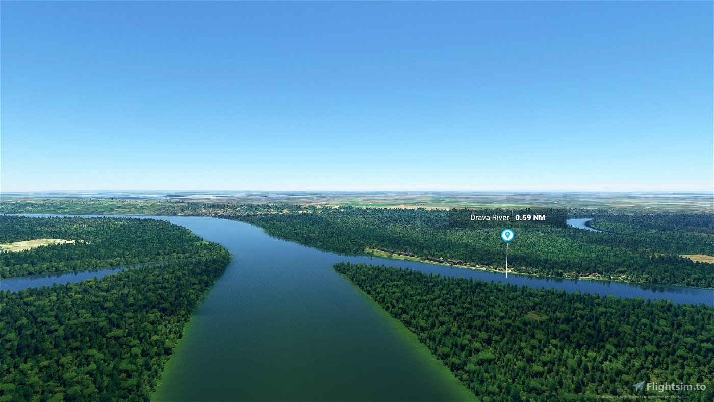
- The GPS is not usable but the river is relatively easy to follow.
- The weather is freely selectable. Live weather is preset.
- ATC is usable.
- The trip is not over until the engine and electrics are switched off and the handbrake is applied. The best way to do this is to roll into a parking lot. If the leg does not end there, stop near the runway or on the runway. This usually applies to small airfields.
- An LNMPLN file for Little Navmap is included in the package.
Have fun with the flights and always safe landings,
Koschi
Created with BushTripInjector by BuffyGC.
Addons
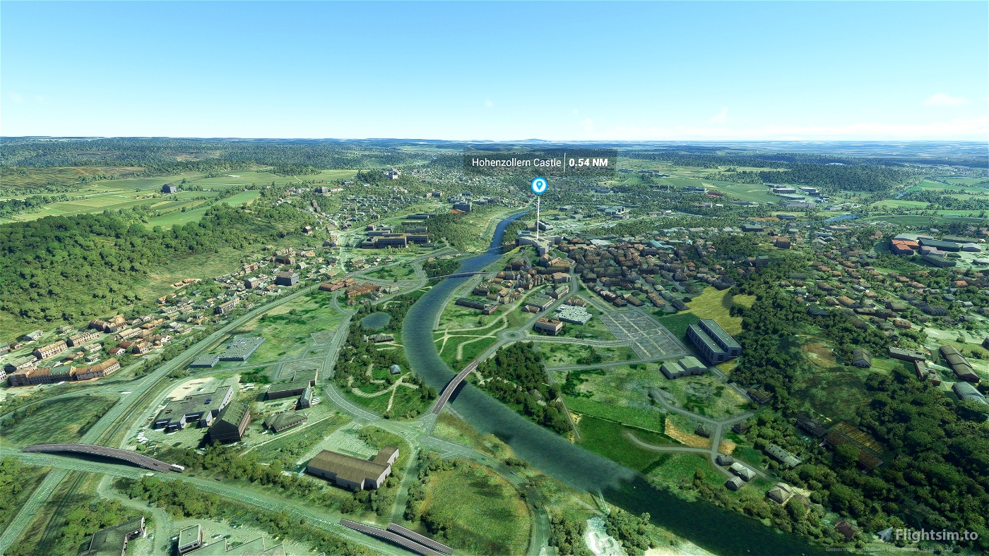
Addons are not required for these flights. For a better experience, I recommend installing the following addons at this point:
Burg Kreuzenstein by rossiro68
Kastelburg Waldkirch by bestform
Partizan Stadion - Belgrad - Serbia by EnjoyItFly
Rajko Mitic Stadium by Jeppeson2001
Gundremmingen Power Plant by michelvp
Walhalla by Wiizard
Belgrade Scenery by Ivusenko by Ivusenko
Bratislava - Slovakia by EnjoyItFly
Bratislava - South - Slovakia by EnjoyItFly
Budapest (Further North) by steveli
Galati 2021 Photogrammetry Romania by dinamogabry
Giurgiu by dinamogabry
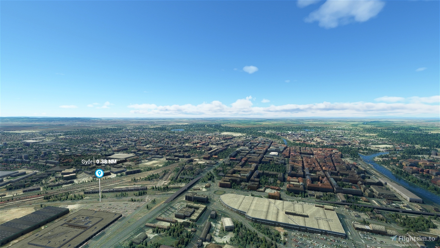
Gyor, Hungary, Enhanced Scenery (Downtown only) by b3nc3
Ingolstadt,Germany nr Munich by marktaylor
Linz 2022 Photogrammetry Austria by dinamogabry
Novi Sad by vizipok
Passau - Germany by EnjoyItFly
Regensburg,Bavaria,Germany by marktaylor
Tulcea - Romania by dinamogabry
Ulm - Germany by kelarius
Vienna Donauinsel by Tribalowski
Vienna Landmark Pack by Troglodytus
Vienna Ring Road by Tribalowski
Vienna West by Tribalowski
[EDMV] - Vilshofen Airport, Germany by Troglodytus
[LOLO] - Linz Ost Airfield, Austria by Troglodytus
EDTM Mengen Hohentengen by CTS
HungaryVFR - LHDV by ekre
HungaryVFR - LHTL by ekre
EDMS Straubing-Wallmühle by jbplayer
EDTF City Airport Freiburg by Christoph Maschowski, Akaflieg Freiburg e.V.
Gyor-Per Airport by matemate
LZIB_M.R.Stefanik airport_MSFS by Flying Partners Slovakia
The daily new releases in this field gives it worthwhile to expand this list independently. Please also post in the comments.
Abenteuer Donau - Europas Geschichte
Von der Donauquelle ans Schwarze Meer
Die Donau entlang zu fliegen ist ganz sicher keine Weltreise aber eine Weltenreise durch die Welten der Geschichte, Kultur und Entwicklungen der Europäischen Staatengemeinschaft. Als ich anfing, diese virtuelle Reise im Simulator zu planen, konnte ich nicht ahnen, wie fesselnd es ist, Einblicke in die verschiedenen Epochen von Krieg und Frieden, von Vernichtung und Entwicklung oder von Vergangenheit und Gegenwart an Orten zu bekommen, an denen ich zum Teil noch nie gewesen bin.
Von den Anfängen des Römischen Reiches, entlang der Donau, bis hin zum Ende des 2. Weltkrieges, gab es in Europa kaum ein Jahrzehnt des Friedens. Selbst in den Jahren 1991-1995 herrschte ein fürchterlicher Krieg auf dem Balkan, dem zehntausende Menschen zum Opfer gefallen sind. Wieviel Blut dieser Fluss doch gesehen hat und meistens hat er Menschen voneinander getrennt. Im Römischen Reich als Limes Via Istrum, welcher die abendländische Kultur von den Barbaren schützen sollte (als ob die keine Kultur gehabt hätten), und noch heute ist die Donau überwiegend Grenzfluss zwischen verschiedenen Staaten und Nationen. Doch es gibt inzwischen viele verbindende Brücken über die Donau, über die Menschen zueinanderkommen können. Wenn wir diese Brücken auch in unseren Köpfen bauen könnten, würde es den Menschen in Europa so gut gehen, wie nie zuvor.
Installation:
Entpacke den enthaltenen Ordner aus dem Paket in den Community-Ordner. Starte den Simulator neu.
Spezifikation:
- Über 27 Legs geht es die Donau entlang von der Quelle bis zu ihrem Delta ans Schwarze Meer. Die Mission hat eine Länge von insgesamt 1.400 nm, mit einer durchschnittlichen Länge der Legs von etwa 60 nm.
- Die kleine FlightDesignCT ist dafür das optimale Flugzeug, vor allem, weil einige sehr kurze Pisten zu bewältigen sind. Das Flugzeug ist mit etwas Handarbeit austauschbar, siehe Exchange-Datei. Alternativ gibt es dazu auch den MissionChanger von BuffyGC.
- Das Paket ist multilingual in den Sprachen: Englisch US, Spanisch, Französisch, Italienisch, Polnisch, Portugiesisch BR, Portugiesisch, Russisch, Niederländisch, Finnisch, Norwegisch und Schwedisch. Die grundlegende Sprache ist Deutsch. Die anderen Sprachen sind maschinell übersetzt, darum können Fehler in der Übersetzung enthalten sein. Wer eine bessere Übersetzung hat, kann sie mir bitte schicken.
- An jedem Wegpunkt gibt es Anweisungen in Englisch aus der künstlichen Sprachausgabe, wenn man den entsprechenden Wegpunkt überfliegt. Alle Anweisungen sind aber im NavLog nachlesbar. Trifft man den Wegpunkt nicht, hat das aber keine weiteren Auswirkungen. Wichtig ist nur, dass man auf dem richtigen Flughafen landet.
- Das GPS ist nicht nutzbar aber dem Fluss ist relativ leicht zu folgen.
- Das Wetter ist frei wählbar. Live-Wetter ist voreingestellt.
- ATC ist nutzbar.
- Der Trip ist erst beendet, wenn Motor und Elektrik abgestellt sind und die Handbremse angezogen ist. Rolle dazu am besten auf einen Parkplatz. Beendet sich das Leg dort nicht, halte nahe der Piste oder auf der Piste. Das trifft meistens auf kleine Flugplätze zu.
- Eine LNMPLN-Datei für Little Navmap ist im Paket enthalten.
Ich wünsche viel Spaß bei den Flügen und immer sichere Landungen,
Koschi

 Koschi


Hello, do you plan to update this wonderfull flight ?
2 years ago
Hello letarsier,
I have already updated this flight 5 times, see change log. Do you have any suggestions what should be updated?
Greetings, Koschi
2 years ago
Koschi
letarsier
nice!
for the better experience I would recommend HungaryVFR also! 😊
https://flightsim.to/file/397/hungaryvfr-fs2020
3 years ago
Thank you. Already recorded.
3 years ago
Koschi
ekre
I'm on the 5th or 6th leg and I'm enjoying this very much. There's a lot of information about cities and POIs included and the description of a leg is rather detailed.
I'm flying this with live weather which can be a bit of challenge with the current summer storms.
I've driven trough parts of this area a lot on the A8, but have never
really stayed there - and the landscape around the Donau is beautiful.
Thanks for the amount of work you put into this!
3 years ago
Thank you VolkerB, for the comment and the rating.
What language do you use in the simulator? I am always looking for people who know other languages and can correct my machine translations from German.
# # # # #
Dankeschön VolkerB, für den Kommentar und die Bewertung.
Welche Sprache nutzt Du im Simulator? Ich bin immer auf der Suche nach Menschen, die andere Sprchen beherrschen und meine maschinellen Übersetzungen aus dem Deutschen korrigieren können.
3 years ago
Koschi
VolkerB
3 years ago
A little bit of challenge should be part of a bus trip. However, the autopilot can still be used well to maintain altitude and direction.
3 years ago
Koschi
stelch
How do you choose what language to use?
3 years ago
The language for the trip can not be explicitly selected. It only changes with the basic language intelligations of the simulator. If the language of the simulator German or English, the trip is also played in German or English.
3 years ago
Koschi
stelch
Thank you for the great work so far. I'm flying now into the night, how can I change back to daylight?
3 years ago
Is that the right flight or do you mean another? Here something should not happen. If it is actually the right flight, you can do the following:
Open this file with a text editor
[FS2020 folder]\LocalState\MISSIONS\ACTIVITIES\DONAU-TOUR-BLACKSEE_SAVE\DONAU-TOUR-BLACKSEE_SAVE.FLT
Search for the line block
[DateTimeSeason]
Season=Summer
Year=2021
Day=154
Hours=11
Minutes=0
Seconds=0.055555555969476699829
Set the desired time there, save the file and restart the simulator.
3 years ago
Koschi
koord
Thank you very much for your work and your sharing.
I did not know the area, so it was a pleasant surpris and, thanks to your comments, I managed to learn a lot of things !
I also appreciated the short legs idea; it is perfect when you have one hour available for a short trip.
Can't wait to discover you new trip ideas. 😊
3 years ago
Thank you for this comment and rating. More ideas from me can be found here:
https://de.flightsim.to/profile/Koschi/uploads
3 years ago
Koschi
letarsier
And thanks for sharing this with the community!
PS im using the C152 which gives great visibility and matches the airports used.
3 years ago
3 years ago
Koschi
piperdriver0624
3 years ago
3 years ago
Koschi
CaptJohnCoPPickles