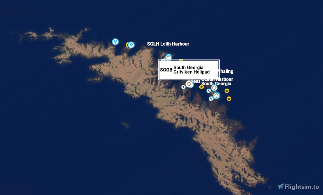
New Helipad/Airfield Scenery for SGGO Ocean Harbour, South Georgia, Southern Atlantic Ocean.
It is part of the British overseas territory of South Georgia and the South Sandwich Islands.
Argentina also claims the territory.
"SGGT Ocean Harbour" msfs map identification.
Navigation Location 54°20'26.7"S 36°16'03.7"W -54.340759, -36.267700
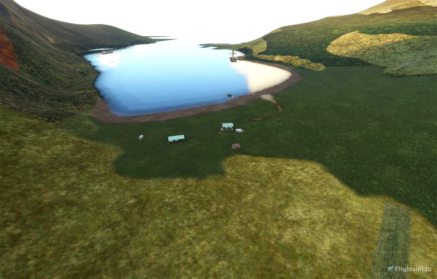
This is very basic msfs scenery, with a fictitious Heliport/runnway at Ocean Harbour on South Georgia.
This allows for Stol aircraft to take off & land.
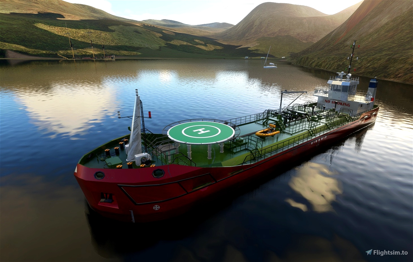
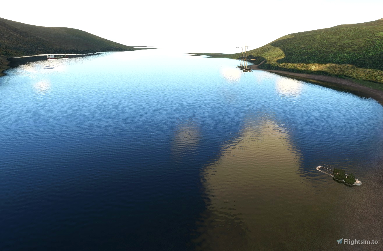
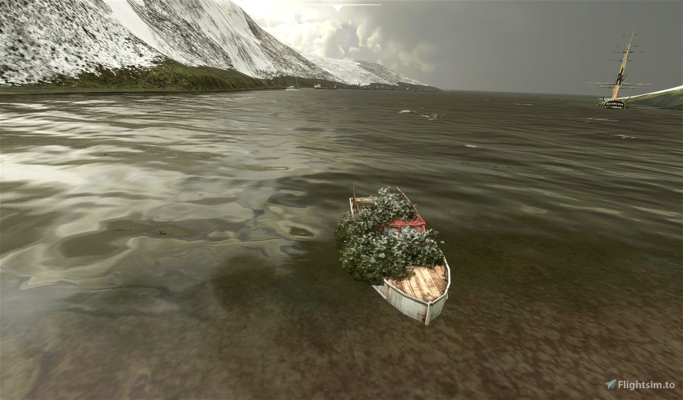
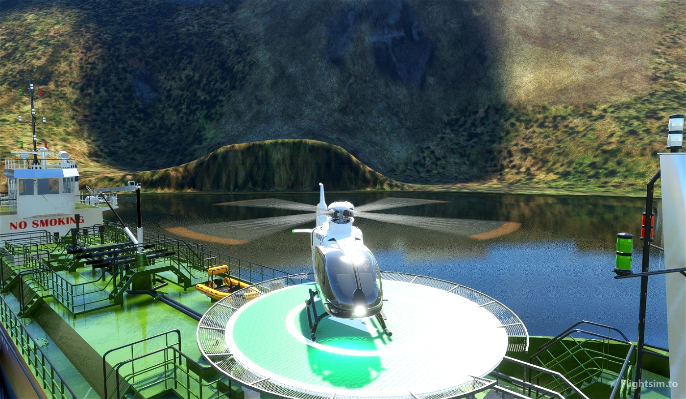
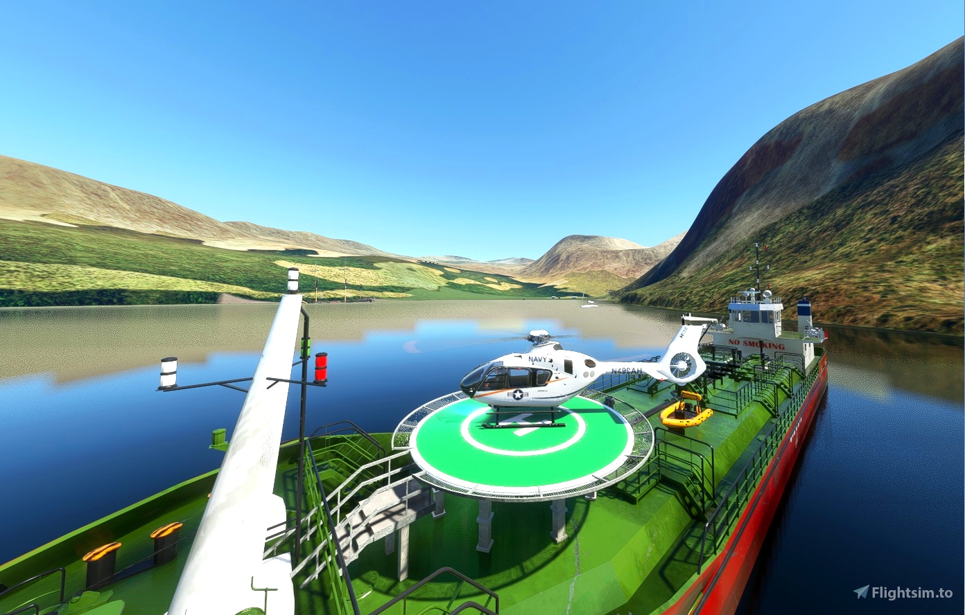
A small refueling vessel in in the bay with "Landable" Helipad.
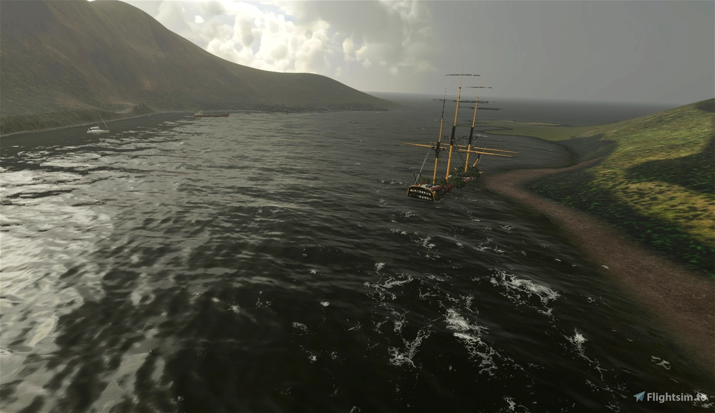
Real elements of the scenery - The wreck of the Iron Sailing vessel Bayard (Coal carrier) is in the bay.
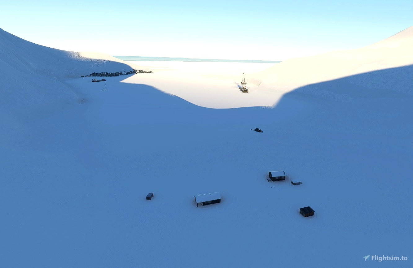
Little remains of the old whaling Station buildings. Another base on South Georgia, to more easily explore the area.
Check the weather! Summertime is best! Based on misc information & images. All original msfs models etc used.
Info.
The island of South Georgia was first sighted in 1675 by Anthony de la Roché, a London merchant and (despite his French name) an Englishman. The island appeared as Roche Island on early maps. The commercial Spanish ship León, operating out of Saint-Malo sighted it on 28 June or 29 June 1756. James Cook circumnavigated the island in 1775 and made the first landing. He claimed the territory for the Kingdom of Great Britain, naming it the "Isle of Georgia" in honour of King George III of the United Kingdom. British arrangements for the government of South Georgia were established under 1843 British letters patent. South Georgia became a base for whaling beginning in the 20th century. A Norwegian, Carl Anton Larsen, established the first land-based whaling station and first permanent habitation at Grytviken in 1904.
The station operated until 1965. Whaling stations operated under leases granted by the Governor of the Falkland Islands.
Government - Executive power is vested in the Monarch of the United Kingdom and is exercised by the commissioner, a post held by the Governor of the Falkland Islands.
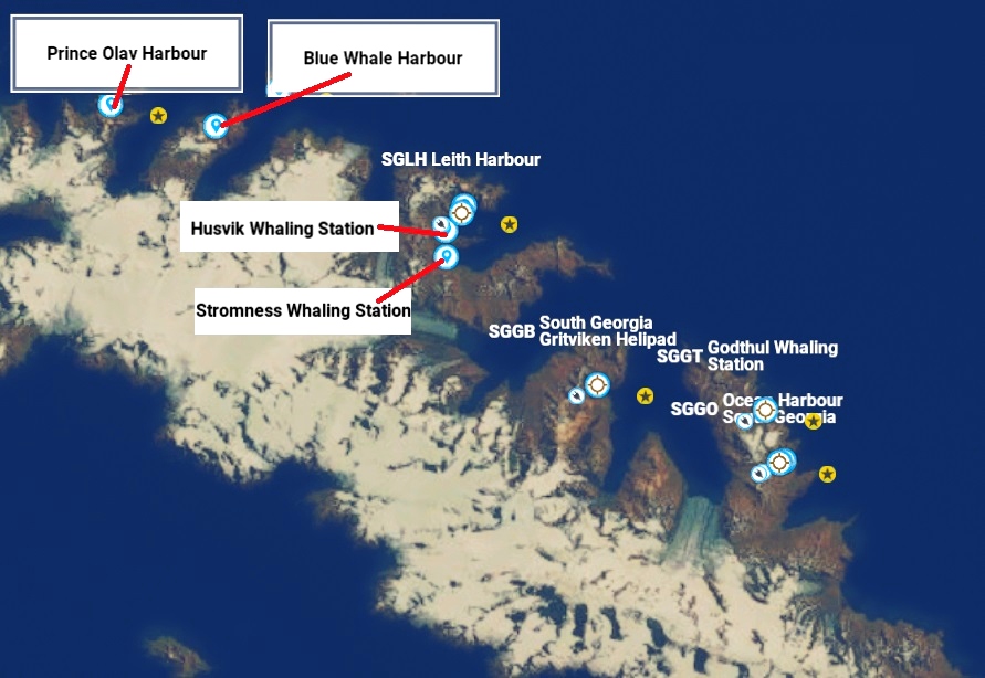
Seven Stations all based on the north coast from West to East are -
1) Prince Olav Harbour
2) Leith Harbour
3) Stromness
4) Husvik
5) Grytviken
6) Godthul
7) Ocean Harbour
Wreck in Ocean Harbour - The "Bayard", was a three masted, 67 metre long, iron 1,028 ton, sailing ship built by T. Vernon and Son, Liverpool for the Hall Line in 1864. In 1868 she was transferred to Sun Shipping Company and in 1881 sold to Foley and Company. On 20 August 1883 she arrived in Suva, Fiji carrying 494 Indian indentured labourers from Calcutta.
She had previously carried indentured labourers to the West Indies. On 6 May 1885, Bayard hit an iceberg, 55 miles (89 km) South of Cape Race while on a voyage from Marseilles to St. Pierre. The ship lost her stern, bowsprit, jib-boom, foremast, topgallantmast and yard, but reached her destination on 23 May, leaking badly. She was later used as a coaling ship for the whaling station in South Georgia. Bayard lost her mooring at the coaling pier in Ocean Harbour during a severe gale on 6 June 1911 and ran aground on the rocks on the southern side of the bay, where the wreck still remains, as a breeding site for blue-eyed shags.
Installation - After unzipping, place the complete "sac-airport-sggo-ocean-harbour-south-georgia" folder
into your MSFS community folder.
Thats it, Have fun. See link below to Grytviken scenery.
sggb-grytviken-whaling-station-south-georgia-southern-atlantic-ocean
Big thanks to GBZH35 to make the landable helipads making part of this update possible.
https://flightsim.to/profile/GBZH35
https://flightsim.to/file/10748/helipads-pack-4-shapes-pbr-textures-fully-customisable
Any suggestions/errors for the scenery please ask or comment.
Thankyou to all who enjoy these free downloads, its fun making them & hopefully the quality
will improve with experience.
If you like them please comment & give a star rating.
Click on the Blue "Follow" box for updates so you get notified & click like Red "heart" box, if you did!
Thirsty work!
If you feel you would like to buy me a coffee, use the "PayPal me" button below.
Many Thanks.

 amb7364

