


When Microsoft recently released World Update 7 – Australia, it supposedly included 54 missing airports on that continent. Put aside for now that 8 of those 54 cannot currently be located on the world map, there are literally hundreds and hundreds of other airfields still “missing” in action. They range from farm strips to small licensed aerodromes with sealed runways and official ICAO designators. Unlike much of the rest of the world, the Australian aerial imagery is largely unaffected by errant clouds, so most of those airfields can be easily located in the sim, if you know where to look. Landing on them is a different matter though, since the default landscape mesh is very “rough”, with many small and large undulations that don’t exist in real life. The only way to fix this is to create simulator runways at those locations, which “flattens” (and terraforms) the mesh. My intent is to fix a few of them. So, let’s get started with a baker’s dozen from Far North Queensland (FNQ)…
FNQ is the northernmost region of Australia’s “Sunshine State”. It encompasses the Wet Tropics that stretch from just north of Townsville along the Great Dividing Range up towards Cooktown (including the regional centre of Cairns). Further north lies the immense Cape York Peninsula, consisting of large tracts of savannah woodlands, pockets of rainforests and vast mangrove swamps along its western fringe. And towards the west lies the Gulf Country, savannah grasslands dissected by massive seasonal rivers that shed monsoonal rains into the Gulf of Carpentaria. Dotted amongst this vast landscape are cattle stations, mine sites and a few small towns (if you can call them that). And almost every one of those has an airstrip, because driving to some of them would take days, even when the roads aren’t inundated.
As it so happened, back when I was a young Padawan, FNQ was where I studied the arcane art of operating mechanical flying contraptions in a commercial (“for pay”) environment. Now, we didn’t call ourselves “bush pilots” or anything (that’s a term best applied to those nutty folks operating into unprepared forest clearings just a little shorter than required by the POH, in New Guinea, the Congo or Alaska), but much of FNQ is what you’d call “remote”, and you certainly had to have your wits about you. For starters, this was in the days when push-button navigation had just started to become an (expensive) option in new airliners. So, our (even then) 20-something year old light twins certainly didn’t come with G1000s or GTN750s. Ground-based navigation aids were also few and far between, so even though we filed IFR for reporting purposes, navigation was primarily by Mark I Eyeball, assisted by compass and the Cooktown, Normanton and Townsville WACs (and the occasional mud map if the boss had been to a particular place before). Queensland might be called the “Sunshine State” but that didn’t mean clear blue skies in FNQ. During the “Wet” we had to content ourselves with monsoon conditions (for legal reasons best described as “marginal VFR”), whilst in the “Dry” there was widespread smoke-haze (for legal reasons best described as “marginal “VFR”).
Anyway, you’re probably sick and tired of my blathering by now, so I will for now omit further descriptions of my actual adventures in FNQ, so here are the airports covered by this mod (btw. The ICAO designators are by and large fictitious):
YQ01 Cannibal Creek
There used to be a gold mine nearby. People still fossick for fun. The strip itself is short and nasty, with a steep dam embankment on the approach end of 06 and the road cutting it in half. If there are 4x4s in the area (which probably won’t stop for you) you’ll get plenty of warning by their trailing dust clouds. There’s no dust during the Wet, but you won’t have to worry then, because it’s not that kind of road.
-16.2022 144.4637
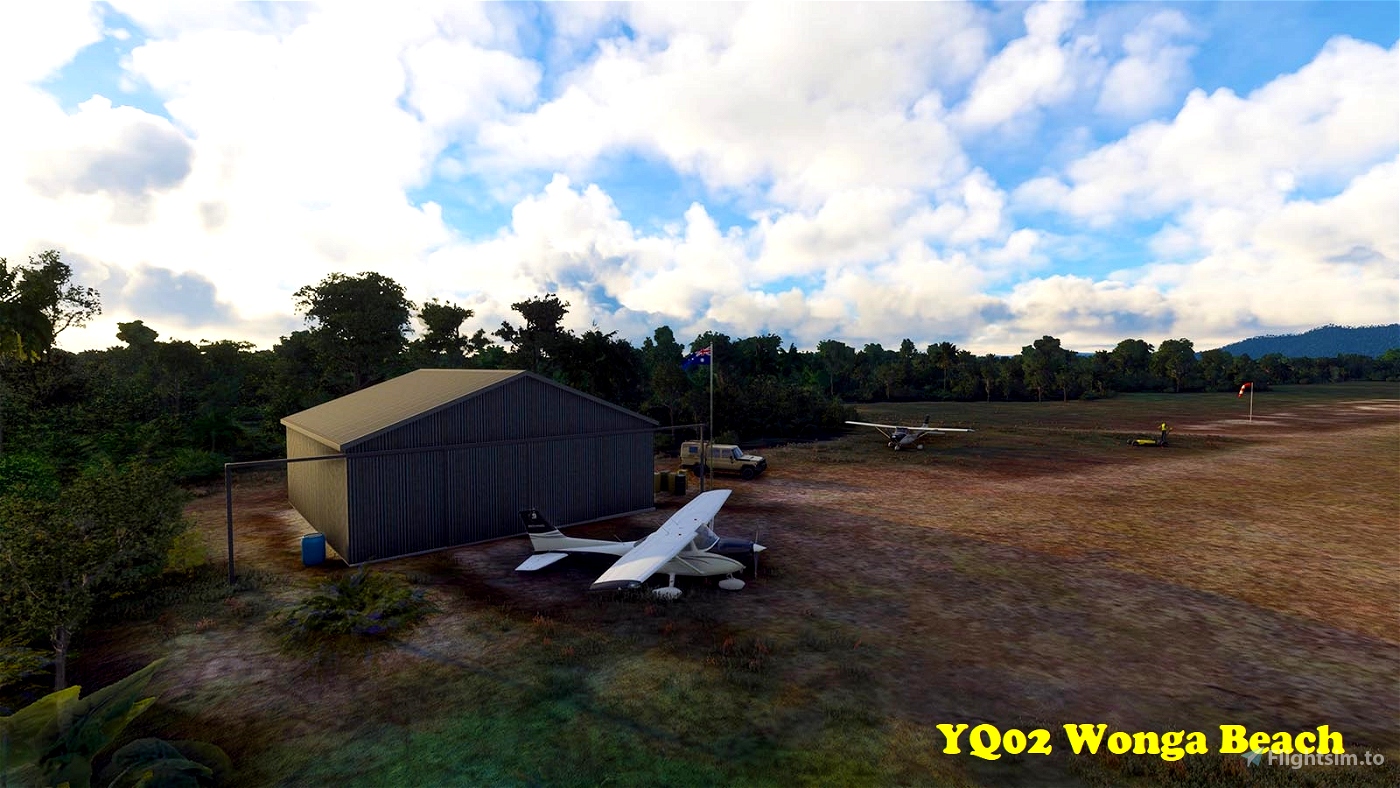
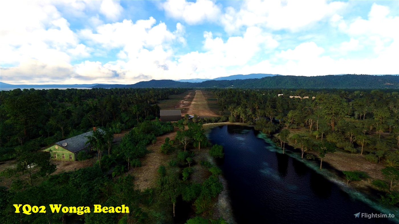
YQ02 Wonga Beach
This one, as the name applies, sits at the other end of the comfort spectrum. Located a few miles north of exclusive Port Douglas, and just south of the Daintree, it has a 1,100m long well-maintained all-weather dirt strip, in walking distance of the eponymous beach. I think you’ll need permission to land there though…
-16.3212 145.4219
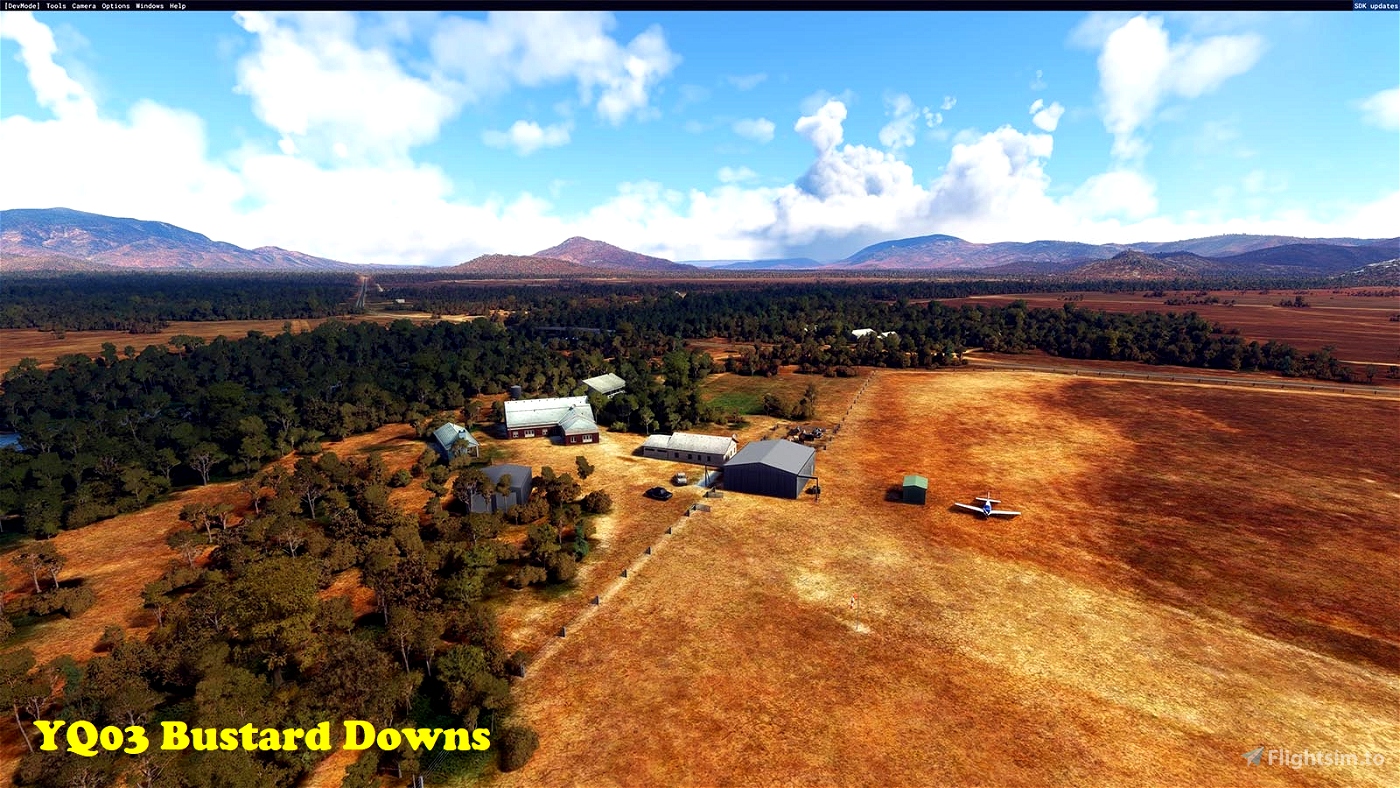
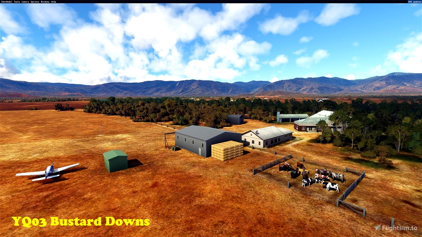
YQ03 Bustard Downs
Not far from the coast, but already much drier, as it sits in the rain shadow of the ranges. The strip belongs to a small cattle station (“organic” these days) and is on the short side (550m). They have “farm stays” available, but brush up on your STOL skills, especially if you’re intending to land towards the west, as the approach comes right over the homestead.
-16.5739 145.1822
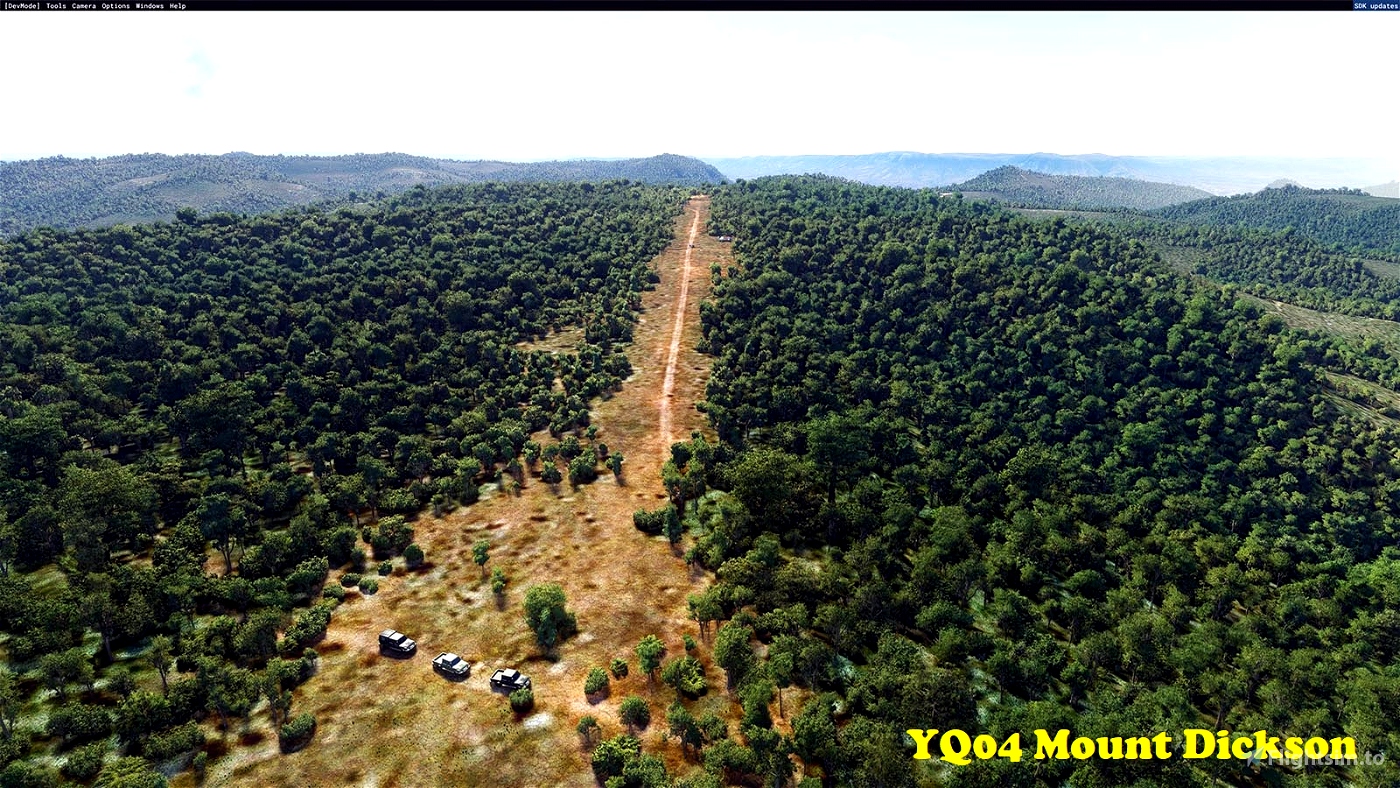
YQ04 Mount Dickson
Located just west of Cooktown (YCKN), I’ve resurrected this one in MSFS, but it looks a bit overgrown in real life. I have no idea what this was used for in the past, but do watch out for campers and 4WDers, because it’s narrow with quite a bit of slope.
-15.4689 145.0582
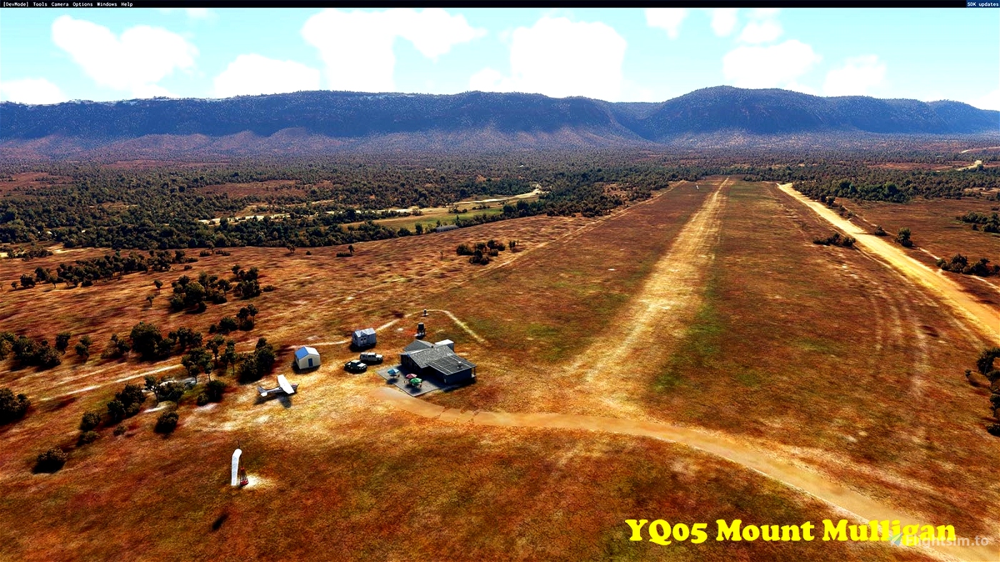
YQ05 Mount Mulligan
Sitting below the impressive table-top cliffs of Ngarrabullgan (the Aboriginal name for Mount Mulligan) this is a well-maintained all-weather strip. It does feature a moderately steep slope down towards the river (Rwy 29), so pick your landing direction well. Nearby Mount Mulligan (ghost) town once was the site of a busy coal mine. However, tragedy struck in 1921 when an underground explosion killed 75 miners (every single miner in town), from which it never recovered.
As part of this mod, I cleared the illegal dwellings on the flanks of Ngarrabullgan (all 28,000 of them). I’m sure they had a great view, but sheesh!! (Azure AI at its worst I suppose).
-16.88 144.8969
YQ06 Cabana Station
This strip belongs to a cattle station on the dry western slopes of the ranges. A very basic strip, with a considerable “hump”.
-18.0284 144.0479
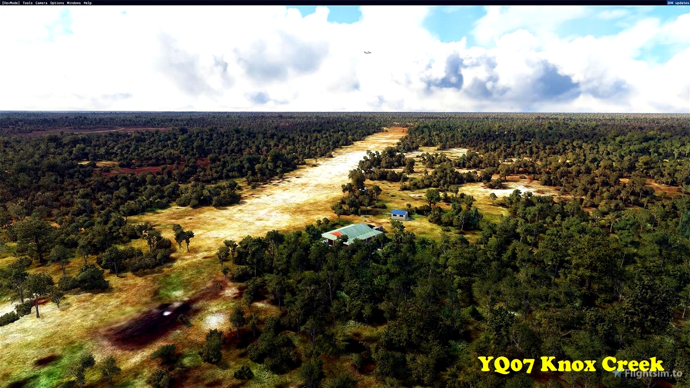
YQ07 Knox Creek
A very basic strip located at a homestead on the remote western shore of Cape York Peninsula. The place is surrounded by coastal wetlands. 5m crocodilians and mozzies nearly as big, come to mind…
-14.0522 141.6819
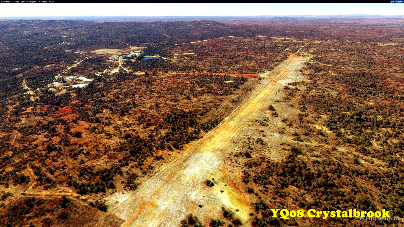
YQ08 Crystalbrook Station
Another cattle station on the dry side of the ranges. They offer luxury accommodation and private barramundi fishing expeditions in their own dam!
-17.3804 144.4503
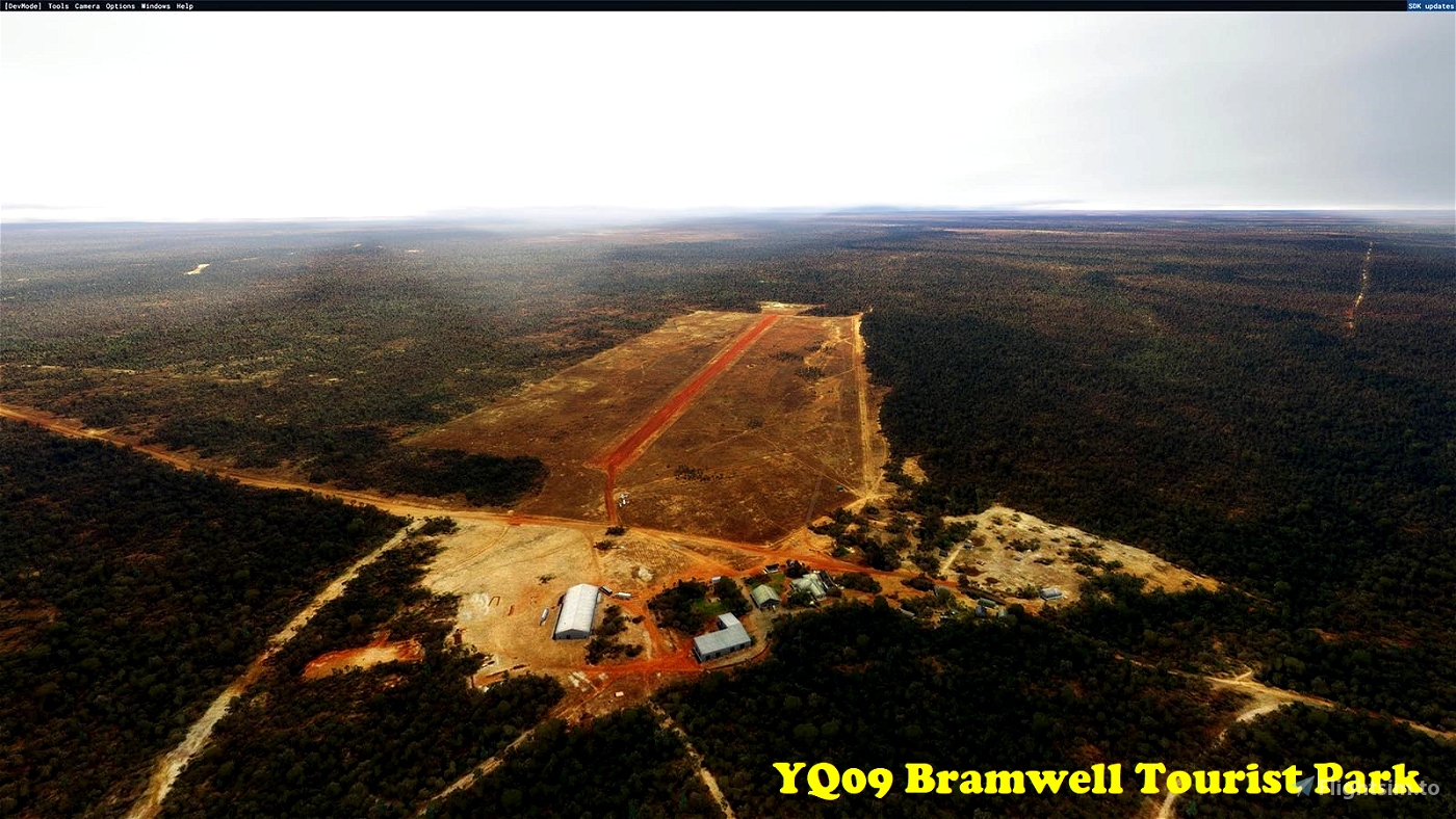
YQ09 Bramwell Tourist Park
Fancy name for a service station with a caravan park, as you approach the tip of Cape York. Here’s an excerpt from their web blurb: “The Bramwell Tourist Park offers plenty of cold beer and great meals, as well as campgrounds and accommodation units in a picturesque Cape York setting, adjacent to the original homestead and cattle yards. We also have live professional entertainers every night from May until the last day of September, so don’t be surprised to get caught up in the fun at night.” Nough said...
-12.1397 142.6143
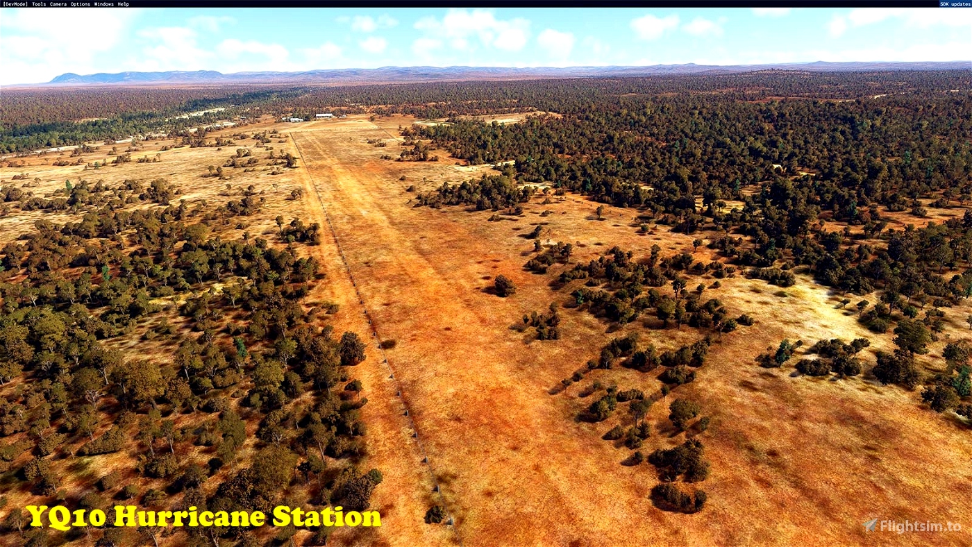
YQ10 Hurricane Station
Forty miles west of Bustard Downs (YQ03), yet another cattle station. A nearby station is called “Karma Waters”. I wonder about the significance of these names… And please leave all gates as you found them!
-16.5802 144.6555
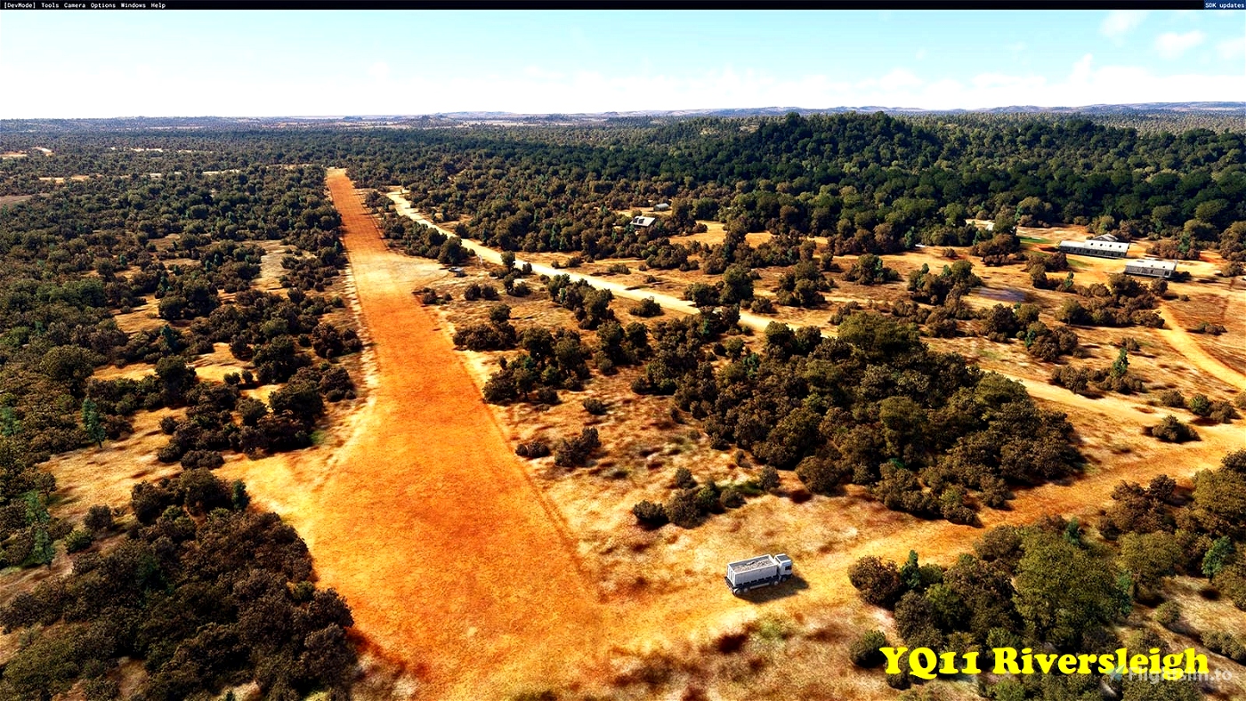
YQ11 Riversleigh
Another cattle station, but this one has considerable scientific significances. Located in the far west, almost at the Northern Territory border (and technically outside FNQ if only by a couple of miles), Riversleigh is the location of one of Australia’s most significant fossil finds. These date back to 5-30 million years ago, when carnivorous kangaroos and marsupial lions roamed the landscape. This is a well-maintained, if narrow strip. The station is now owned by the Waanyi people of the western Gulf of Carpentaria region.
-19.0288 138.7374
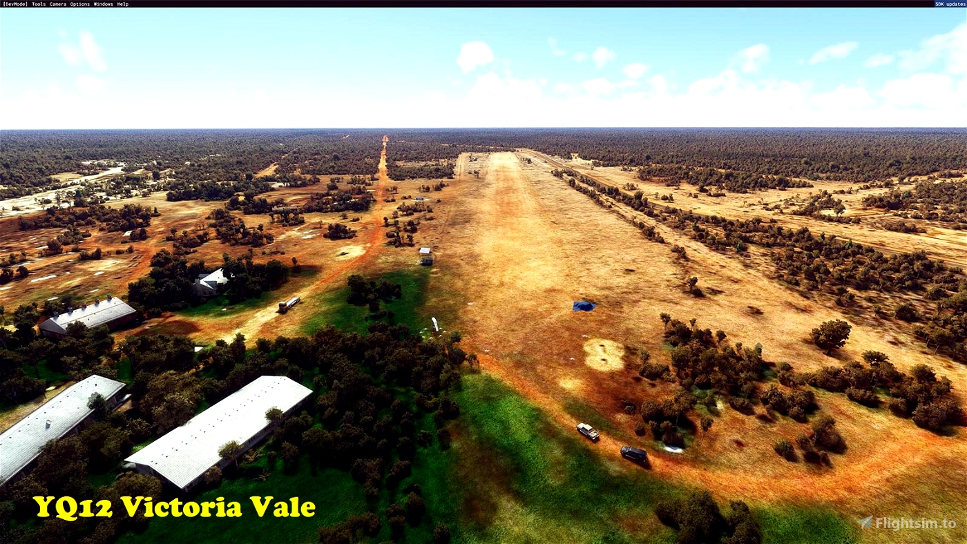
YQ12 Victoria Vale
You guessed it, another cattle station, located on the dry western slopes of the ranges, on the banks of the generally dry Norman River (which during the Wet becomes one of the great rivers shedding the monsoon deluges into the Gulf of Carpentaria. Note: there’s another similar looking airstrip just to the west, but it’s not currently in service.
-19.3589 142.7574
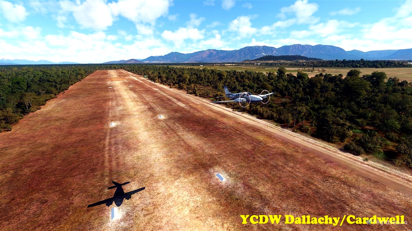
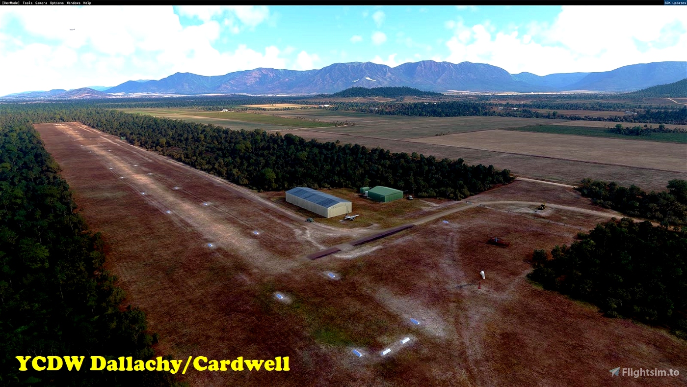
YCDW Dallachy/Cardwell
Owned and operated by the Cassowary Coast Regional Council, this well-maintained dirt/grass runway is located just north of Cardwell. Nearby Hinchinbrook Island is one of the most scenic attractions along the Great Barrier Reef. Check it out, will you!
Installation
Simply copy the included folders into your Community folder. (If you are updating this scenery to a newer version, first delete the existing folders of the same name.)
Dependencies
To see the scenery objects I've placed, you will need to have the following object libraries installed:
MSFS 2020 object library with 190+ models ranging from towers hangars to cones by colinj
https://flightsim.to/file/16007/msfs-object-library-with-150-models-ranging-from-towers-hangers-terminals-to-cones
totof- aircraft library by Totof33120
https://flightsim.to/file/17182/totof-aircraft-library-v1-1
totof- helicopter library by Totof33120
https://flightsim.to/file/17983/totof-helicopter-library-v1
totof-library-object
https://flightsim.to/file/17179/totof-library-object-v1-1
BeeKay-Pack1
https://flightsim.to/file/8887/beekay-pack1
Dave’s 3D Animals Library
https://flightsim.to/file/6841/dave-s-3d-animals-library
Mikea.at - AssetPack by mikea.at
https://flightsim.to/file/1923/mikea-at-assetpack
Windy Things by trfsto
https://flightsim.to/file/14024/windy-things
Collection d'avions pour FS2020 by Jean-Pierre Fillion
https://www.jpfil.com/quebec-fs2020/scenes/Collection-avions.zip
Credit: Jean-Pierre Fillion, Quebec
quebec-fs2020.org
jpfil.com
Many thanks to the library object developers for making them available!
[Note: the scenery will function without these libraries, but will look less interesting.]

 gunther


Im eagerly downloading this but couldnt wait to comment on your excellent description. Very welll written and gave me a giggle. What an amazing experience all that must have been. Looking forward to your mod!
2 years ago
KatanaDV20
I don't think Microsoft *ever* said that they added literally every missing airport in the Australia Update (only *additional* missing airports) but nevertheless good job on this mod despite your misleading premise..
2 years ago
budspencer20
Amazing work mate, really bringing the love to my favourite part of the world. Thank you.
2 years ago
con7inuum
Ah, the Deep North.
Good start, mate, but when you've finished with the DN, there are plenty others that are missing in action!
2 years ago
JohnG
Great initiative! Looking forward to seeing all of them from your POV.
Once again, thanks for your time and for your kindness. Keep up the great work.
2 years ago
ZILL
Takes me back to the FS9 and FSX days of VOZ and OZx. Thank you.
2 years ago
bradallen43
You had me at Wonga Beach. Well done
2 years ago
Fury
Love your work!
2 years ago
sarahymac