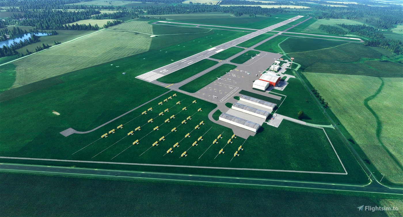
KGBG - Galesburg Municipal Airport - Galesburg, Illinois
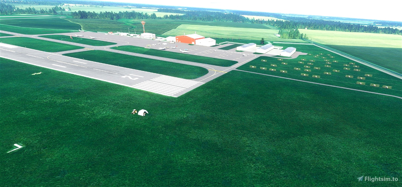
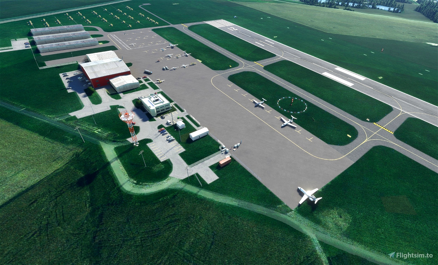
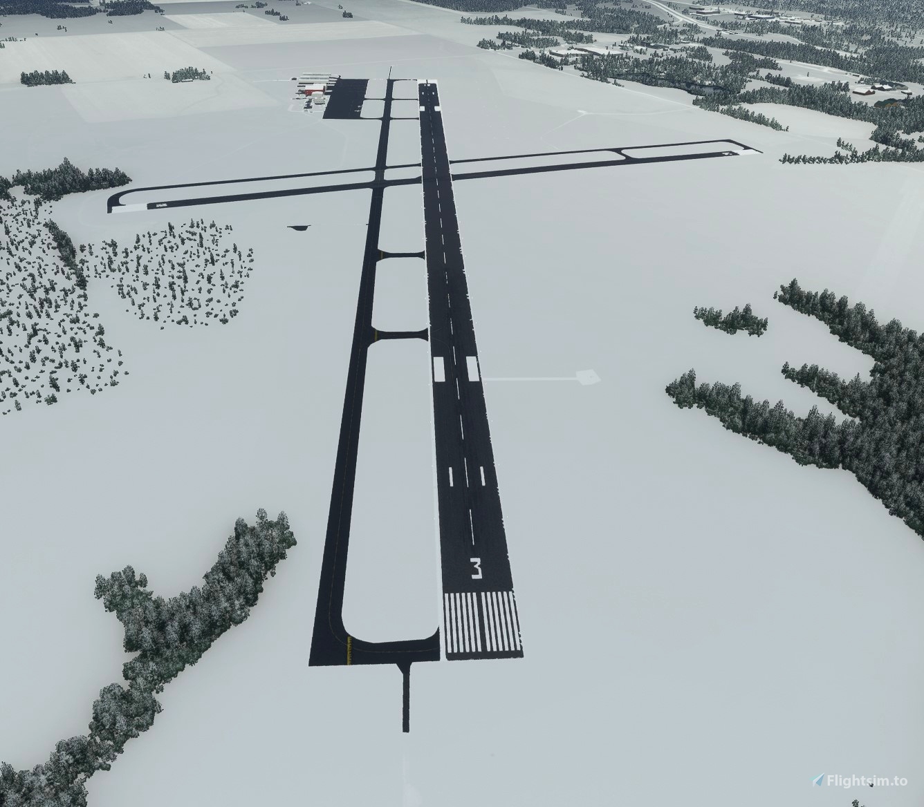
Galesburg Municipal Airport is a mid-sized regional airport in Northwest Illinois. It used to have commercial air service until the 1980's though it hasn't returned since. The airport has two hard surface runways and a single (non-official) grass runway. The main runway (3-21) has a generous 5700+ foot runway and the crosswind runway (10-28) is 3600'. The grass runway parallels 3-21 to the northeast. This airport is pilot-controlled though it was towered until the 1980's. The tower is in the process of demolition and may have already been completed by this writing. It is visible in the sim (flattened) in the field to the east of the runways.
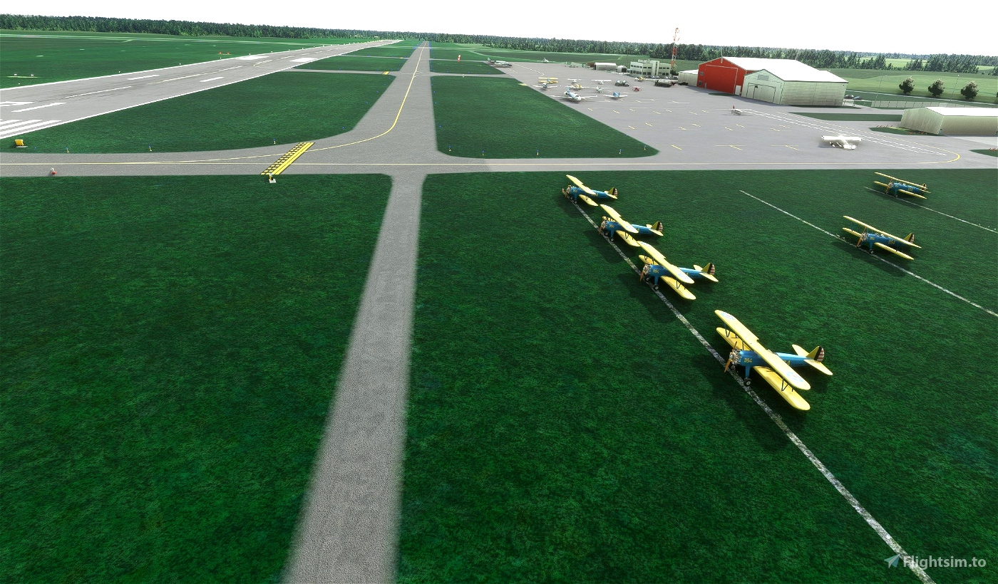
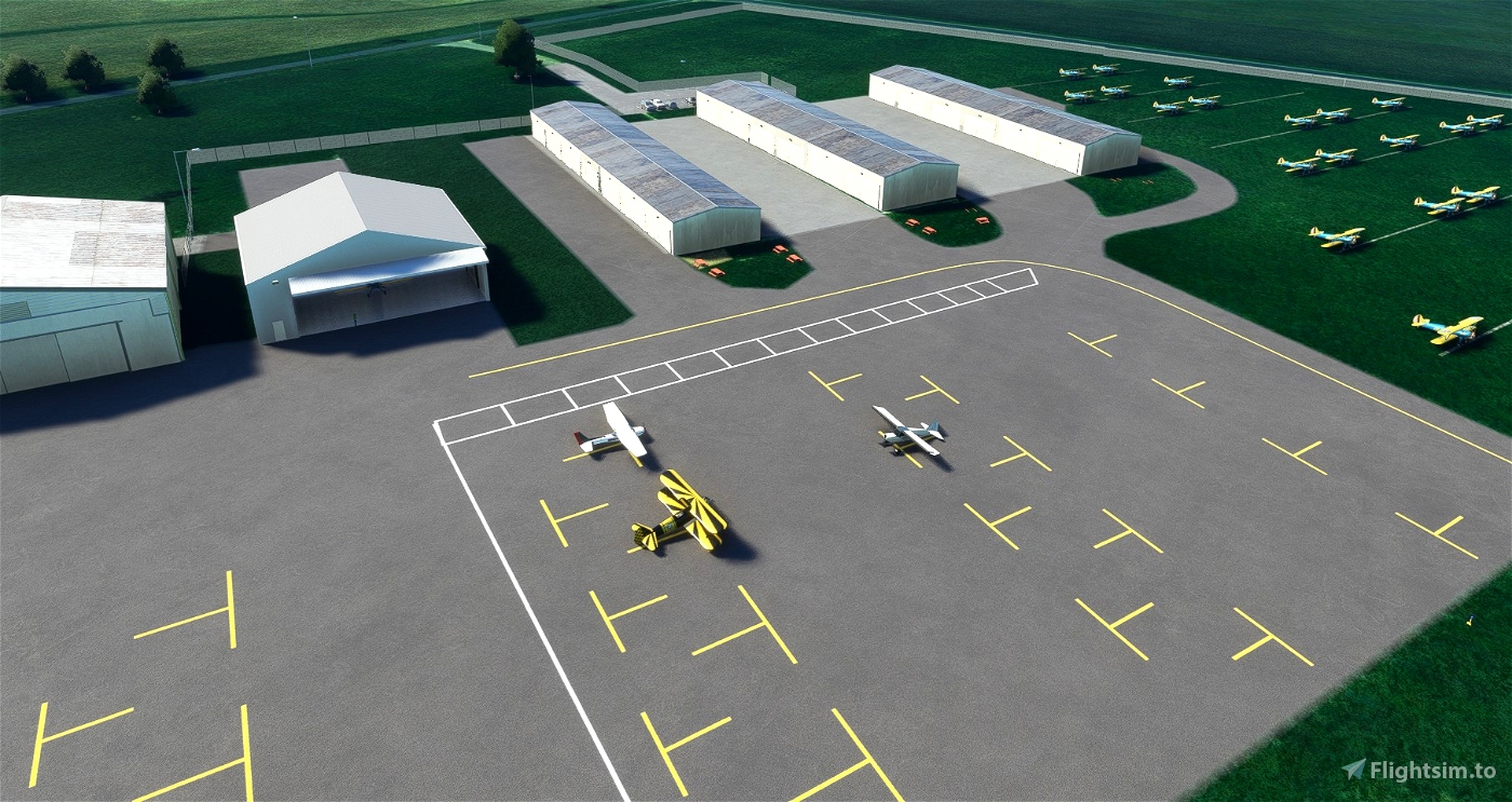
The reason that I picked this airport to work on is that this field hosts the Stearman Fly-In annually. I've been enjoying flying the DC Designs PT-17 Stearman and Galesburg has been hosting the fly in for 50 years. The grass runway is primarily used by the Stearman aircraft. Being designed as a WWII training aircraft and is very comfortable flying from the grass. I have added numerous Stearman aircraft as static aircraft (requires an additional library for them to be visible) so this rendition of the field is of the airport while the fly-in is taking place. It is my understanding that there is a Stearman repair shop on the field as well so Stearman aircraft may be present any time of the year in various amounts of repair. I had hoped to find more time to add additional objects to this scenery, but seeing that I can't find the time to do so, I feel that I can release it and update it later if I can.
Notes:
- Signage has been fixed based on photos and videos I could find
- Windsock locations updated
- Excess trees removed
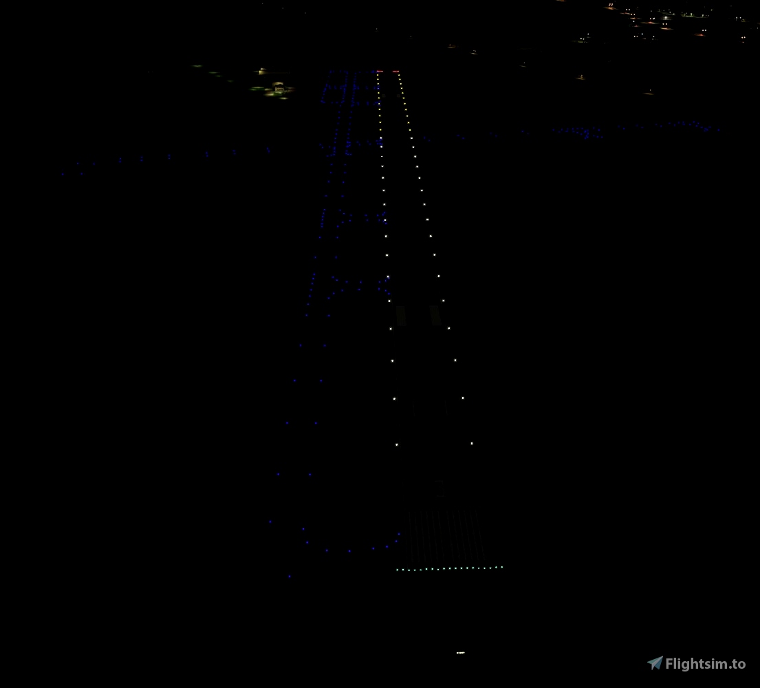
- Hand placed taxiway lights added.
- Lighting has been updated per photos and videos I could find
- Hangars added/updated (some taken from other MSFS World Update airfields. Most are generic assets)
- Static aircraft added. For the Stearman static aircraft, you will need the totof-aircraft-library.
- Added additional parking locations (some in the field so you can start where the Stearmans park for the Fly-In)
Version 1.1 Update
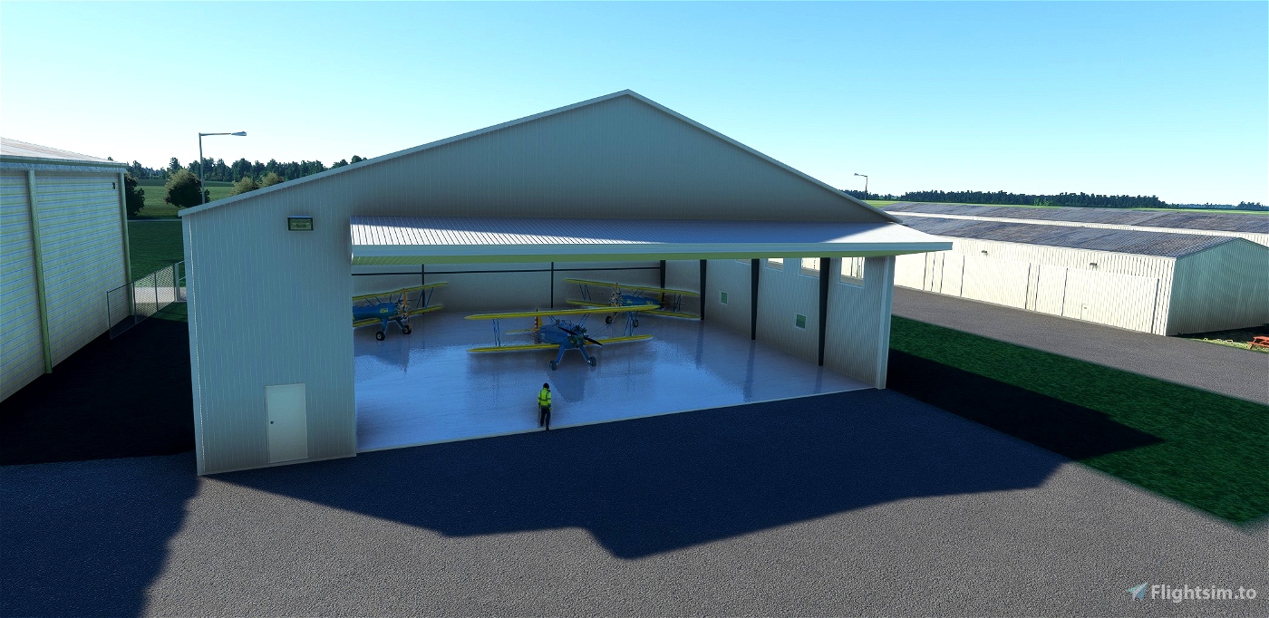
- Added National Stearman Foundation hangar - This is an open hangar from the Windhover library. I know the Real Stearman Foundation hangar is blue, but I like to use Windhovers open hangars so that is what I did. I added a couple static Stearman aircraft inside the back of the hangar.
- Added Parking spot 14 inside the hangar.
Installation:
- Extract the package from the zip file and place in your community folder
Credits:
- I also use objects included from the Free World Updates. As new airports are released, additional scenery objects become available for use. If things are missing, it is likely you don't have these world updates installed. You can download these in the in-game Marketplace for free. I try to have a mix of default and updated objects so there should always be some of the scenery objects present.
When you are done flying in western Illinois, come fly in friendly Minnesota!

 spidermanMN


Excellent scenery...I used to fly to Galesburg in my RW training out of Peru, IL. Brought back some fun-time memories.
2 years ago
Must have been a fun place for a X/C flight from Peru. Thanks for the comment!
2 years ago
spidermanMN
dvlcreations
Can you tell me now exactly you redid the airport? Step by step perhaps? Tools used, etc, thanks! Very nice work. How did you also make sure your sceney was Simupdate 9 compatible?
2 years ago
Hi - Quick overview - My primary inputs for the general area started with Google/Bing maps. Using the SDK, I normally will exclude trees as MSFS is pretty aggressive right now in putting in too many trees. I'll also fix the runway length/width if the default sim got it wrong. Probably the part that takes me the most time is fixing taxiway names and signs. This is tougher on airports like this without airport diagrams. I will say for this airport in particular, I looked at a LOT of still photos from the Stearman fly-in and also higher quality videos off the internet to figure out what what the taxiways were and, maybe even tougher trying to make the signage close to what exists IRL.
Once that was as complete as I could do, I used the same inputs to try to place taxiway lights in the right locations. Some airports have been using reflectors instead of taxiway lights, so I can't do a apples to apples substitution, so there may be taxi lights in places which have reflectors IRL (like my scenery in KMIC). Once that is complete, I move to parking positions and ground markings. MSFS puts parking locations sometimes in very random places, so I try to move them to be more accurate with what exists IRL.
Lastly, I move to the scenery objects like hangars, buildings. I don't have the time right now to learn 3D modeling, so I personally use mostly sim delivered objects though some useful libraries have been shared on this site so I do sometimes use those as well. I try to match objects as close as I can (like the red hangar at KGBG here) with objects I can find in the sim. Some other developers make their own objects and they are really good at it. I'm glad people have the skill to make them!
Lastly I try to place lights around the airport to match off the input photos/videos. The accuracy of the placement of these objects usually depends on how good the inputs are since I don't think I will ever visit some of the airports I've made scenery for. I do find it VERY helpful that people are posting photos/videos of their visits to these airfields. Without those photos I don't think I would attempt much of the work I have to date. As far as the question about SU 9 compatible, this site makes that assumption based on when it's posted. I last built against the SDK for SU9 so I think this site expects that.
So much for a quick overview. Hopefully this helps!
2 years ago
spidermanMN
PeterN0969
Much improved from stock! I'm not sure where the Foundation has placed the Community Center/Hangar as shown here: https://www.stearmanfoundation.org/
2 years ago
Good catch! I think I can guess where it is based on the pictures of the building. It isn't in any overhead maps yet, but I think I know where on the field that is. Hopefully I can find a few minutes to put something there and release another version.
2 years ago
spidermanMN
SilverStateSkies