Distance:150km.Length:1-1.5h. ..
Difficulty:easy. ...
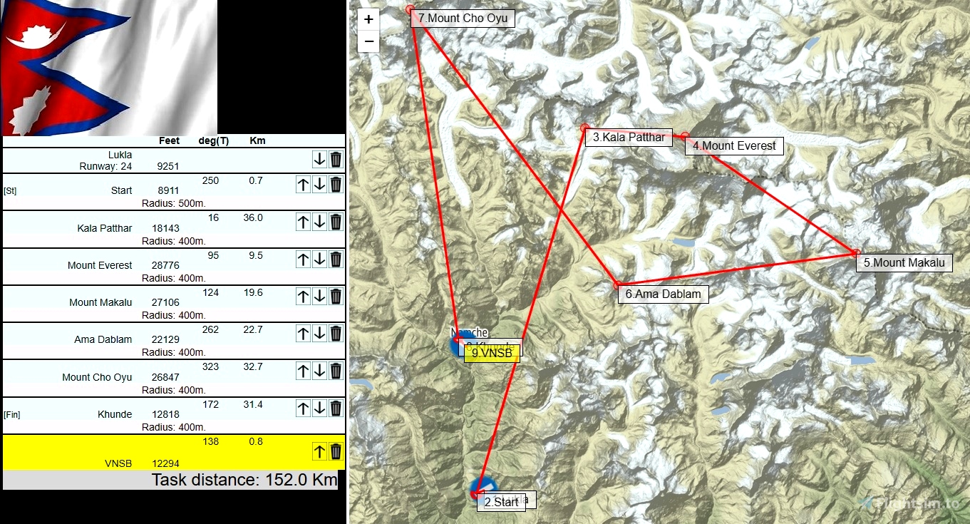
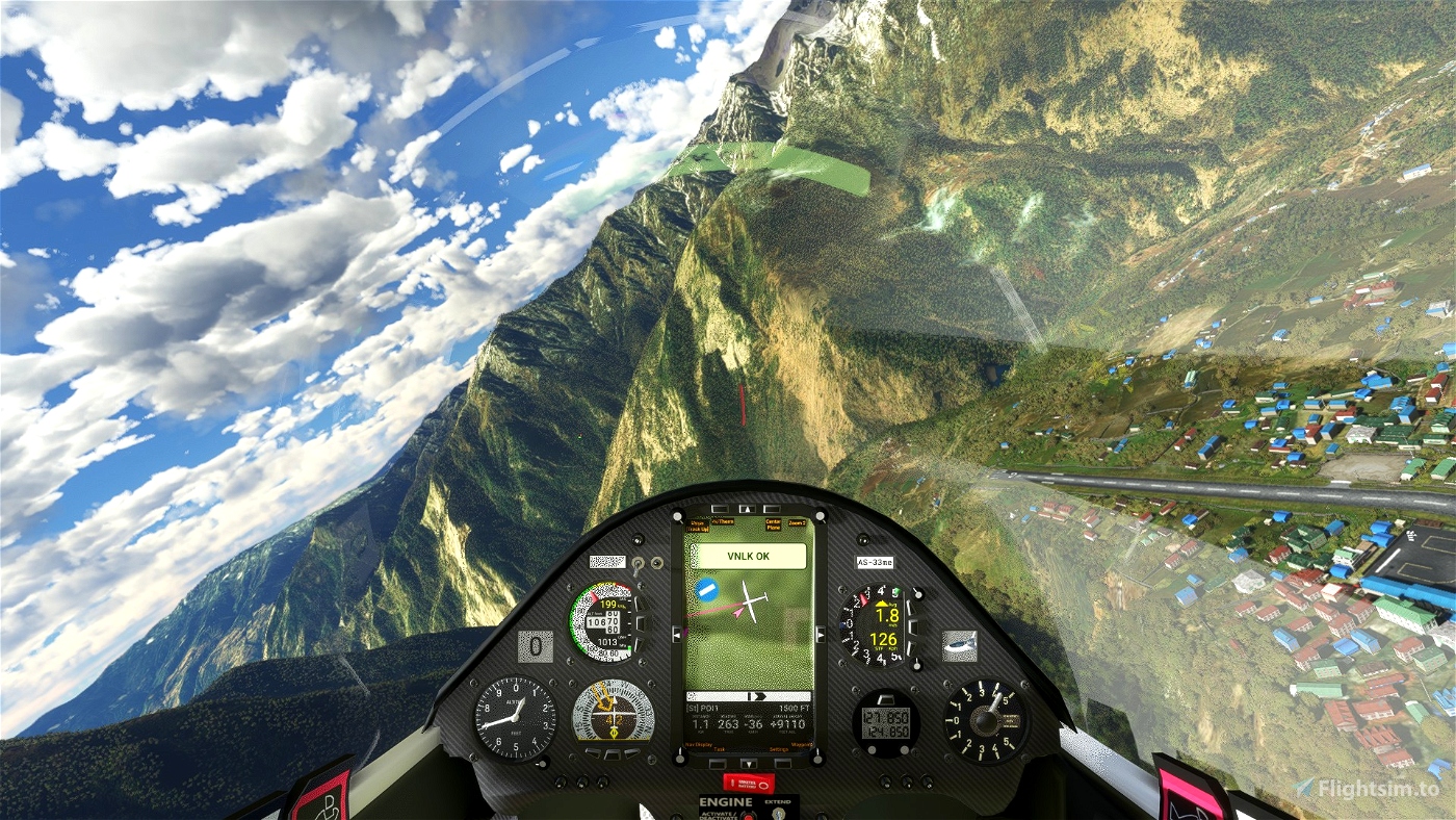
Departure: VNLK Lukla
Destination: VNSB Syangbod
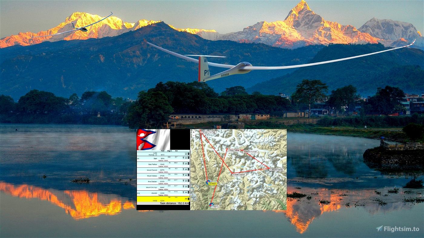
Glider ride on Himalaya Nepal . .
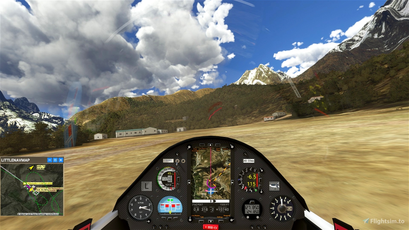
Few clouds, good visibility. Wind 18 knots from S.
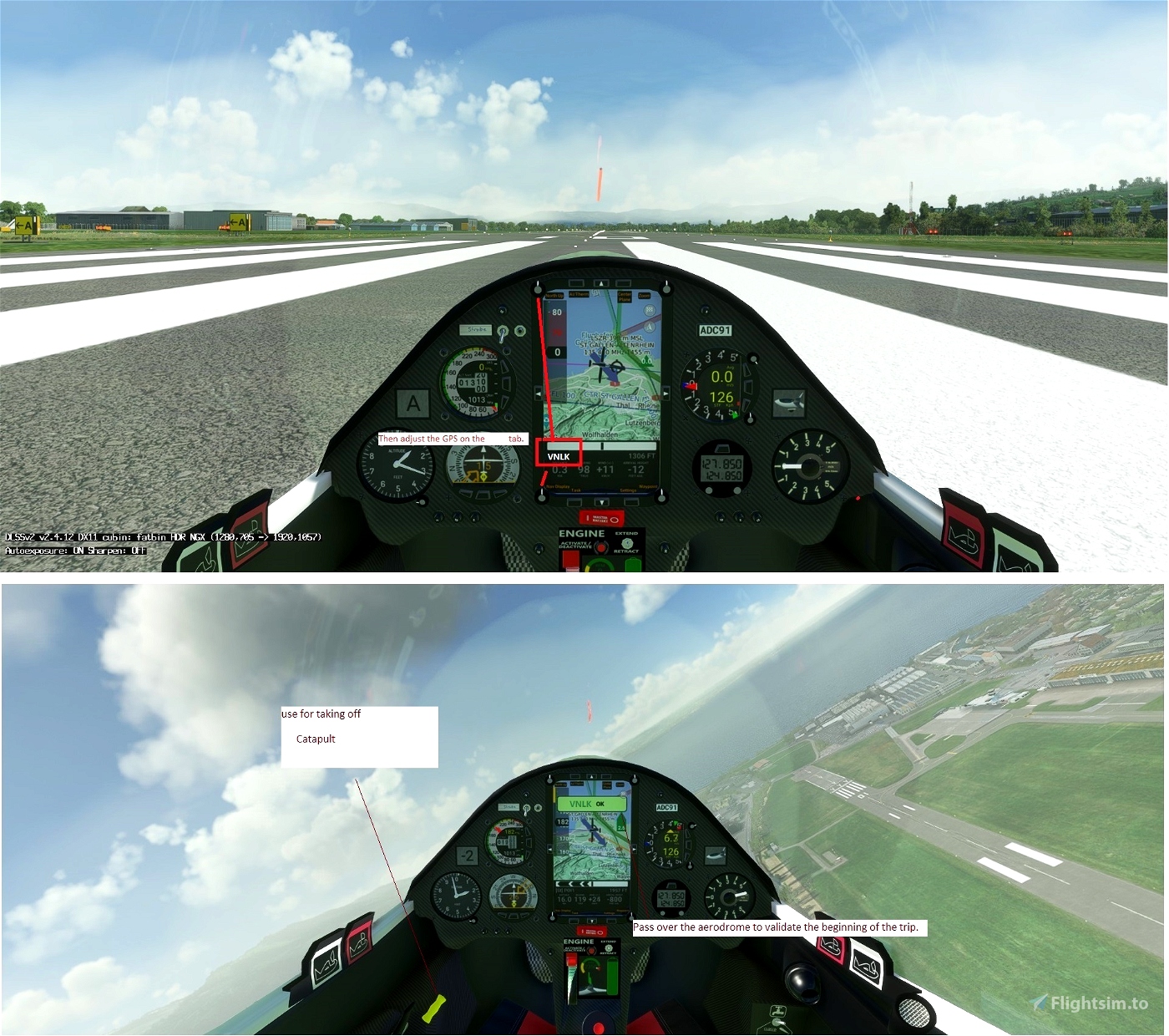
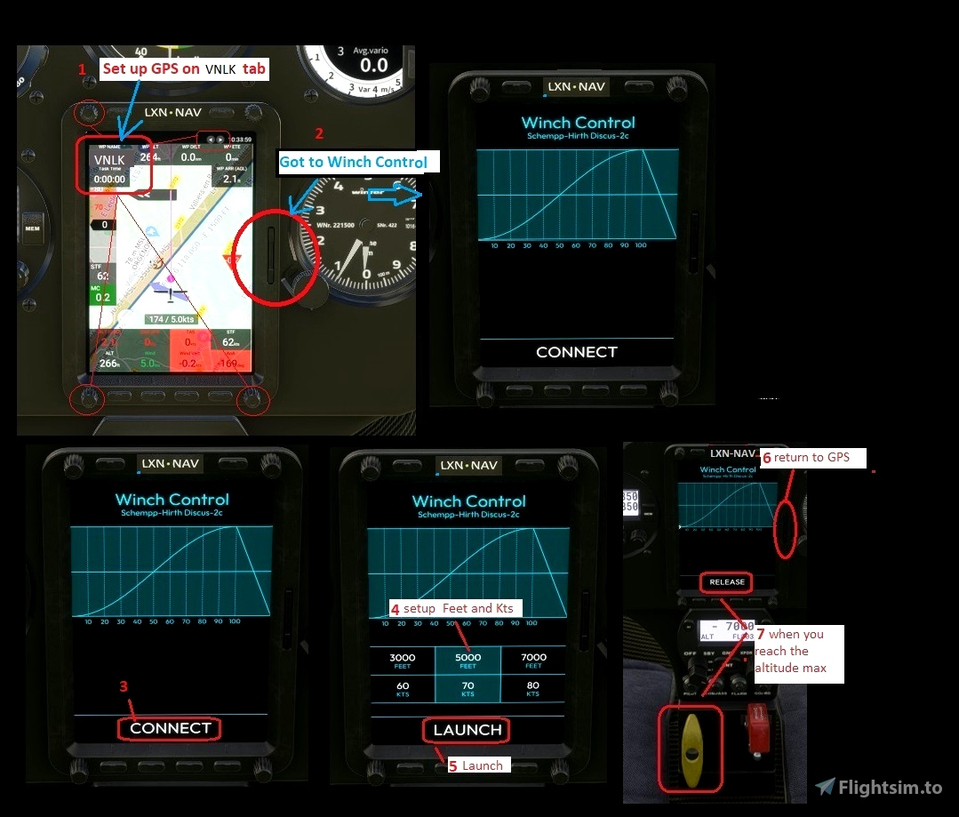
Use and look to GPS to validate all crossing points (notification when done).
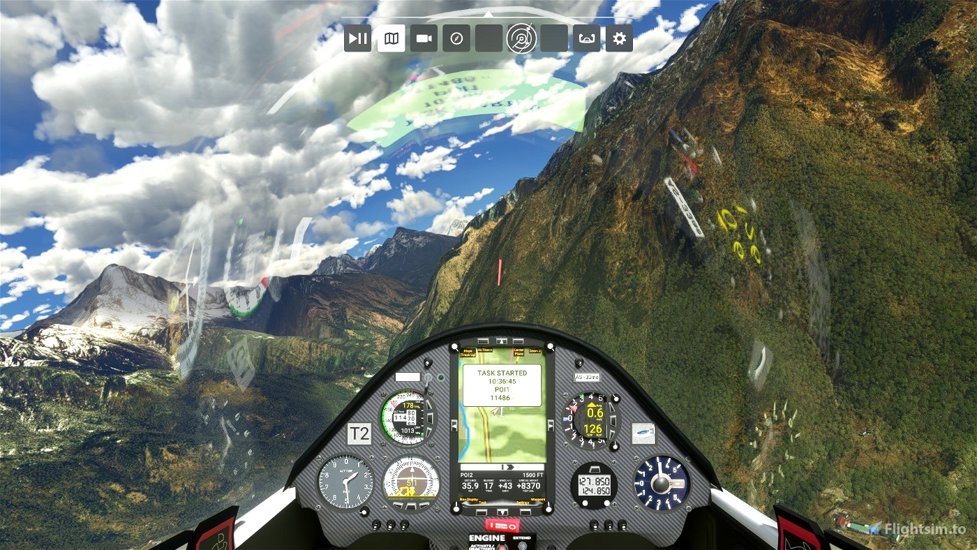
Watch your GPS and wait for the map to finish loading.
Then adjust the GPS on the VNLK tab .
Use your catapult to take off.
Pass over the aerodrome to valid VNLK
Make sure that you have validated the crossing point above the aerodrome.
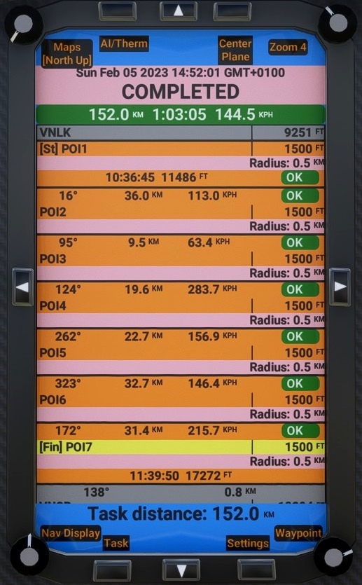
POI1: Starting line. Elevation 10000 feet
POI2: Kala Patthar Elevation 18143 feet
POI3: Mount Everest. Elevation 28776 feet
POI4: Mount Makalu. Elevation 27106 feet
POI5: Ama Dablam. Elevation 22129 feet
POI6: Mount Cho Oyu. Elevation 26847 feet
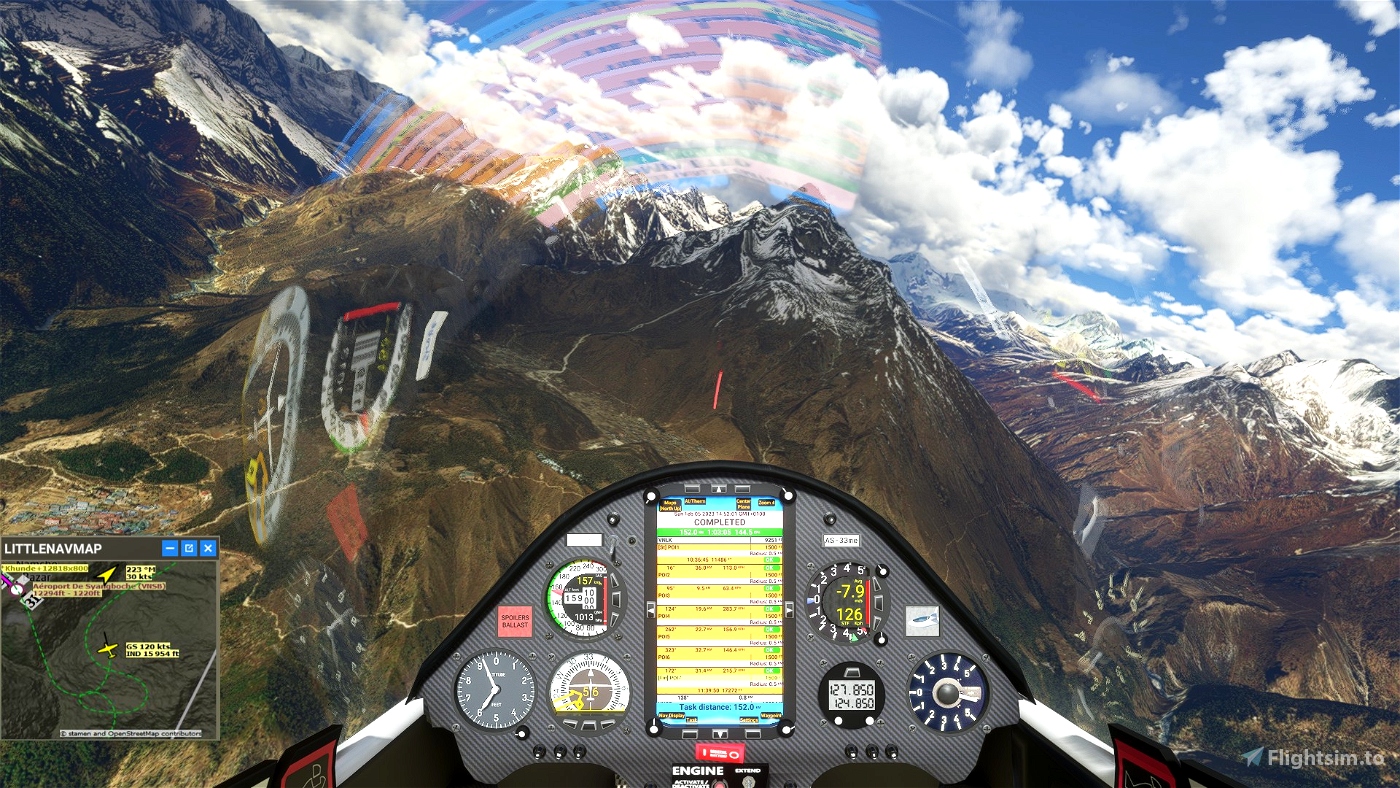
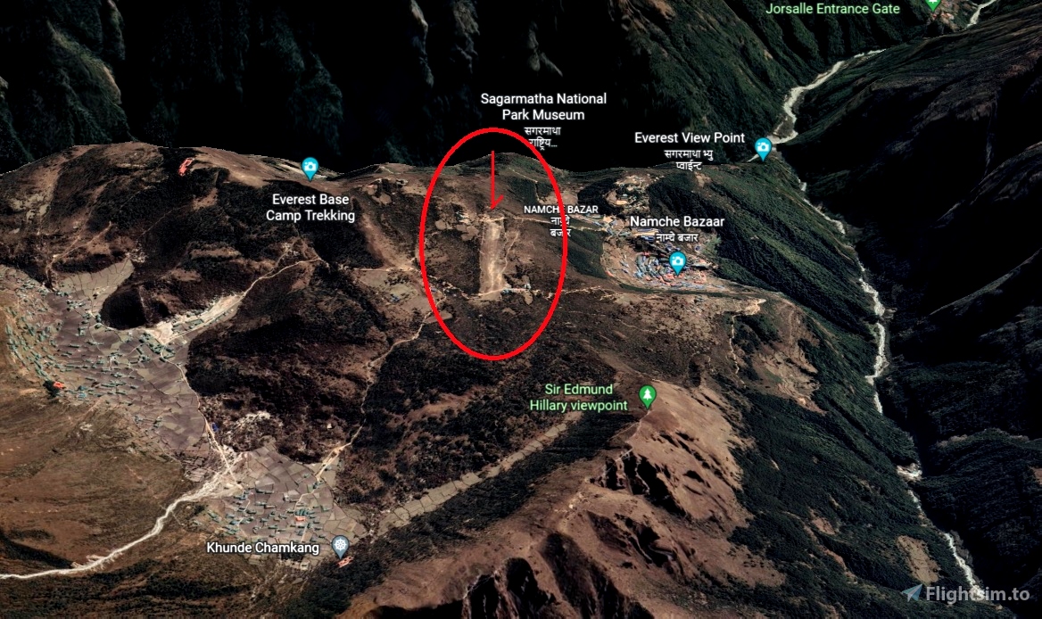
POI7: finish line Khunde. Elevation 12818 feet
go Landing on Syangbod Airport - VNSB 12294 feet
Turn off your main battery when you have landed
MADoloSimulations
ASS33 me 1.83
https://fr.flightsim.to/file/15090/as-33-me
Got Friends
Discus-2c: Premium
https://fr.flightsim.to/product/discus-2c-premium
JackBilbo
https://fr.flightsim.to/discover/LXN%20Nav%20Replacement
MSFS ALBATROSS
DG Flugzeugbau DG-808S
https://fr.flightsim.to/file/30384/dg-flugzeugbau-dg-808s
SCC Sim Soaring Club
https://discord.com/invite/8TaW8QjH
https://www.twitch.tv/videos/1534299342
https://www.youtube.com/GeorgOrtner
https://www.instagram.com/simsoaringclub/

 ADCKillerman

