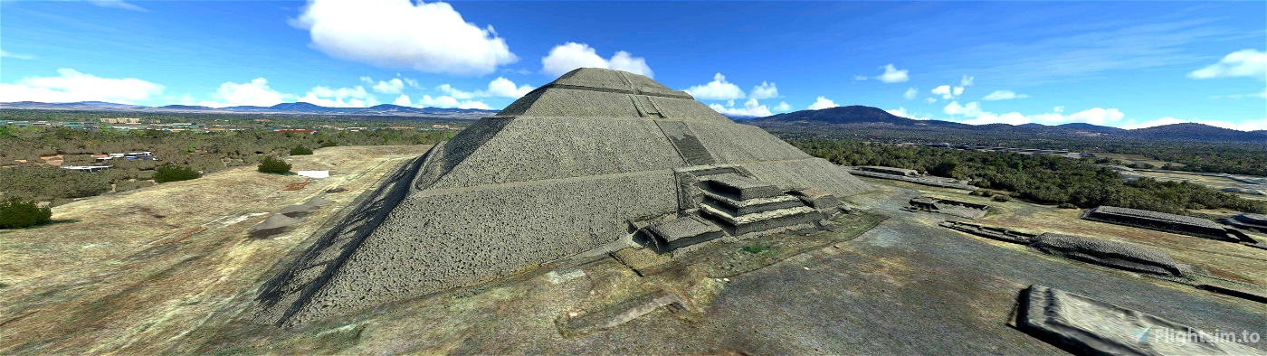
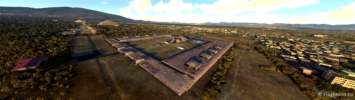
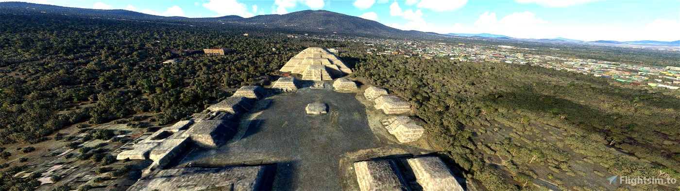
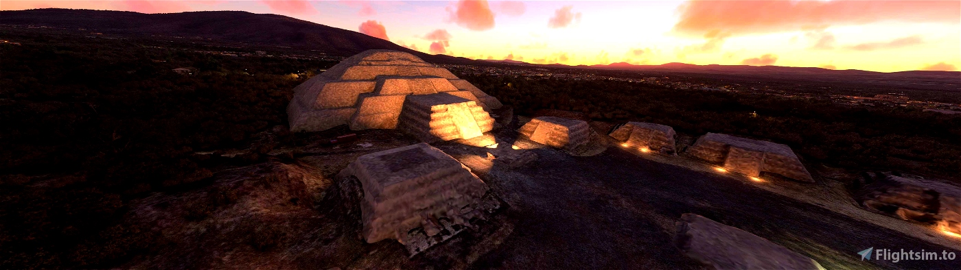
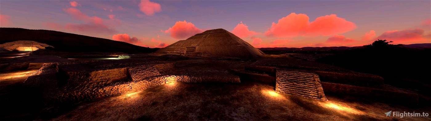
The default scenery for the Pre-Hispanic City of Teotihuacán is somewhat lacking. Due to the lack of custom models and Bing photogrammetry for this area, the Blackshark AI attempts to construct the site automatically by interpreting the 2D satellite imagery. However, as users will note, significant structures like the Pyramid of the Sun are represented by large warehouses or other anachronistic structures.
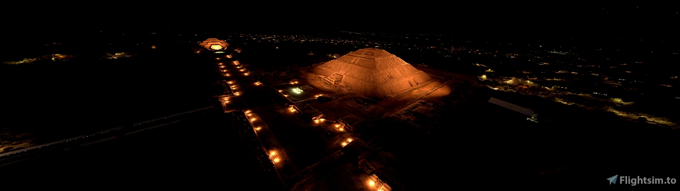
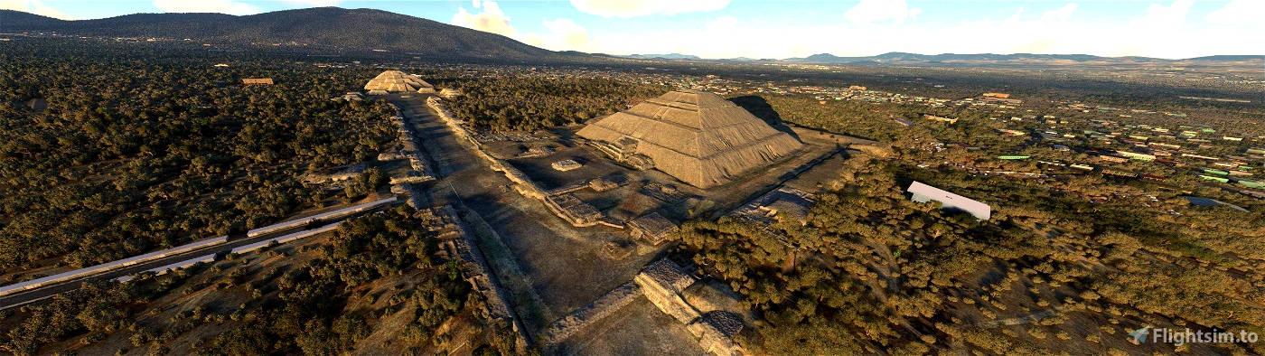
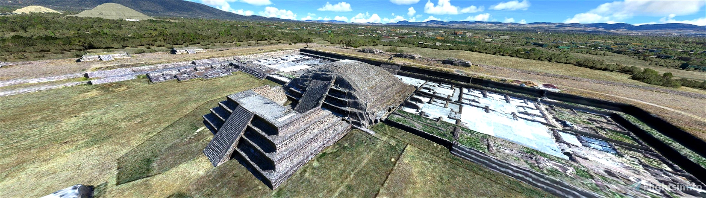
This add-on attempts to address this issue by presenting users with a much improved, and far more accurate overhaul of Teotihuacán. In addition to various ruins, this add-on includes the major buildings, such as the Pyramid of the Sun, Moon, and Temple of the Feathered Serpent (otherwise known as the Temple of Quetzalcoatl). As neither Bing, nor Google have photogrammetry data for this city, photogrammetry data acquired by the Cultural Heritage Xochimilco, and Proyecto Interdisciplinario de la Prehistoria del Oriente de Guerrero (PIPOG) was used as a source for developing this add-on. Further manual modifications were made, including cropping away excess data, fine-tuning some graphical anomalies, making minor color corrections, and stitching together the data in a sensible manner. Extensive terraforming, and tree adjustments were also made to help mesh the photogrammetry more seamlessly with the sim environment. Some built in sim objects were also used to help augment the overall authenticity of the add-on. Where adequate photogrammetry data is lacking, a creative decision was made to simply remove any structures deemed anachronistic. This does not include visitor centers or other modern buildings situated near the site.
NOTE: Users are encouraged to use this add-on in conjunction with derekhe's excellent MSFS 2020 Google Map replacement tool. If you do, it is not necessary to install this add-on's included satellite imagery.

 RiverSkyHigh


Very nice work! Congrats! Something similar should be done with "Monte Albán" in Oaxaca. Cheers!
2 years ago
Alfonsotero
What is the closest airport to this wonderful scenery and perhaps flight directions to the scenery? Thank you very much!
2 years ago
Hello. Closest airport is MMYK, however it is only suitable for small aircraft, or helicopters. This update includes new landmark markings, so if you have those enabled under your assistance options, that'll allow for easier navigation to the area.
2 years ago
RiverSkyHigh
LTCSZ
Very nice. You should add it as a POI though.
3 years ago
Thanks for the input. The next updated version will include this feature.
3 years ago
RiverSkyHigh
archaicpariah
3 years ago
buyaca619
3 years ago
elgallo1
4 years ago
3 years ago
RiverSkyHigh
Socorrista22198
4 years ago
4 years ago
RiverSkyHigh
opjose
4 years ago
Pilot1981
4 years ago
edpatino
4 years ago
4 years ago
RiverSkyHigh
AndresHdz77